
Scientists reveal the hidden forces turning winter into a season of extremes.
Winter weather swings widely due to complex interactions within the atmosphere and oceans. Patterns like the jet stream, Arctic Oscillation, and polar vortex guide cold air and storms, creating sudden temperature changes and intense snowfall. Ocean currents and atmospheric rivers add moisture and heat variances, influencing precipitation types and storm intensity. Understanding these processes clarifies why winter conditions vary so much across different regions and times.
1. Cold air masses collide with warm fronts to create rapid temperature shifts.
When cold air masses from polar regions meet warm fronts, rapid temperature shifts often occur. These collisions can trigger swift changes in weather, causing sudden warm spells or cold snaps. The dynamic interaction between differing air masses drives much of winter’s unpredictability.
Regions experiencing these clashes often see sudden snowfalls or thaws, impacting daily life and activities. Understanding these interactions reveals why weather can feel so volatile, even over short timeframes. Tracking these mass movements helps decode seemingly erratic winter patterns, enhancing preparedness against abrupt changes.
2. Polar vortex disruptions push frigid air farther south than usual.

Polar vortex disruptions significantly influence winter weather patterns. A stable polar vortex keeps frigid air contained around the Arctic. However, disruptions can send blasts of cold air southward, causing extreme cold spells in temperate regions that aren’t accustomed to such low temperatures.
These disruptions occur due to stratospheric changes and shifts in atmospheric conditions, often leading to uncharacteristically cold weather far from the poles. Such events highlight the interplay between high-altitude atmospheric phenomena and ground-level climate conditions, emphasizing the complexity of winter weather dynamics.
3. El Niño and La Niña influence winter storm tracks unpredictably.
El Niño and La Niña are climate phenomena that impact global weather patterns, including winter storm tracks. El Niño typically leads to milder, wetter conditions in some areas, while La Niña often results in cooler and drier weather. These patterns vary widely by region, introducing variability in winter forecasts.
The unpredictable nature of these events can redirect storms, leading to unexpected snowfall or rain in unusual areas. Monitoring these oceanic patterns helps anticipate weather shifts, though precision remains challenging, underscoring the complexity of predicting winter storms.
4. Arctic oscillation phases impact wind patterns and temperature distribution.
Arctic oscillation phases considerably affect wind patterns and temperature distribution during winter. Positive phases usually lock cold air in the Arctic, leading to milder conditions across the mid-latitudes. Conversely, negative phases allow cold air to spill southward, bringing significant cold snaps.
These oscillations highlight how atmospheric pressure differences can alter regional weather experiences. Understanding their phases enables better insight into potential cold or warm spells, illustrating why winter conditions may seem capricious. This oscillation also influences storm paths and intensity in various regions.
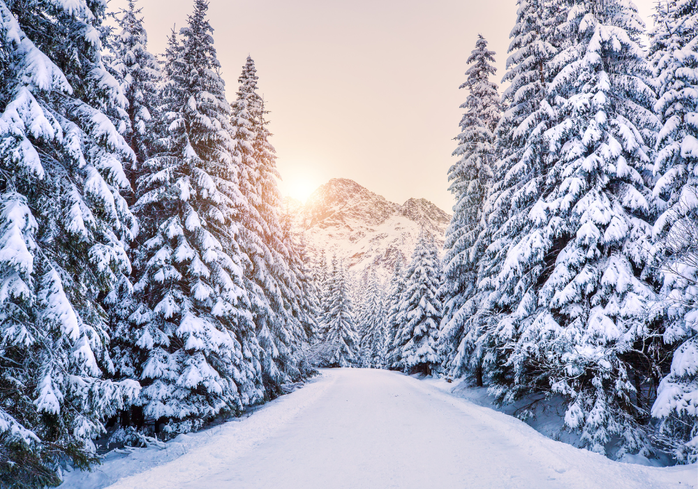
5. Lake-effect snow forms when cold air passes over warmer lake waters.
Lake-effect snow occurs when cold air sweeps across warmer lake waters, picking up moisture and creating heavy snow showers on the downwind shores. This phenomenon leads to intense localized snowfall, often catching nearby areas by surprise with its rapid accumulation and intensity.
The temperature contrast between the lake surface and the incoming air determines the lake-effect snow’s magnitude. Regions near large lakes frequently experience these intense snowbursts, demonstrating how specific geographical features can shape local winter weather distinctively from neighboring areas.
6. Jet stream meanders bring alternating cold and mild air waves.
Jet stream meanders are key in driving cold and mild air waves. When the jet stream undulates, it brings alternating periods of warmth and cold to different regions. This is due to its steering role for air masses, shifting weather patterns across continents.
Such meanders cause fluctuations in temperature and weather stability. A deep dip might bring an Arctic blast, while a rise fetches warmer air from the south. These shifts illustrate the jet stream’s direct influence on winter variability, challenging simplistic cold-or-warm assumptions.
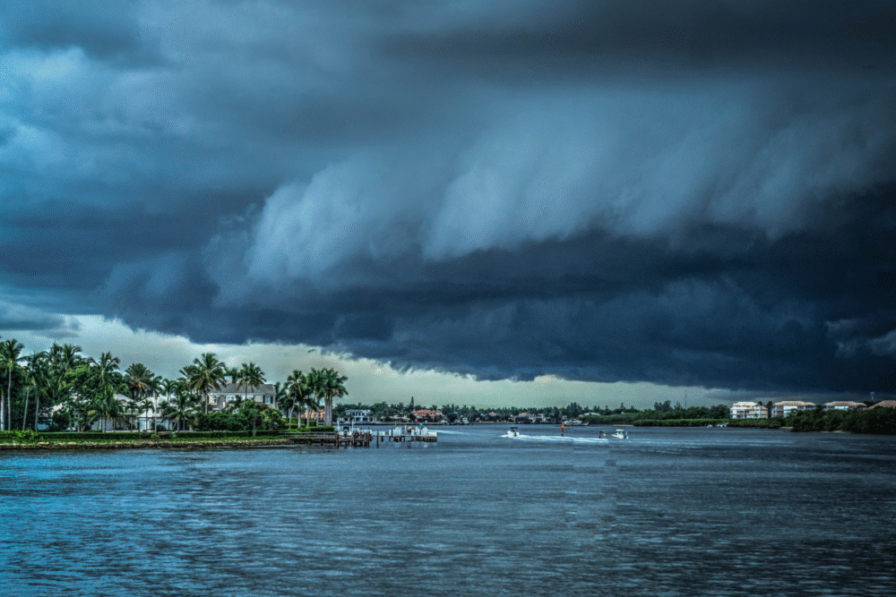
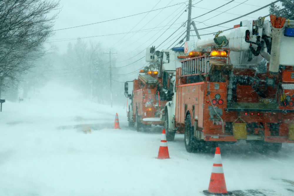
7. High pressure systems can block or redirect winter storms dramatically.
High pressure systems can significantly alter or even block winter storms. These systems direct weather patterns by influencing wind directions, often causing storms to veer away unexpectedly. Their intervention can lead to drier periods or divert intense storms, reducing their potential impact.
When high pressure dominates, areas might experience prolonged calm and clear skies, contrasting with nearby turbulent regions. This blocking effect can leave some locations dry while others eventually face severe weather, demonstrating the nuanced power of atmospheric pressure on winter scenarios.
8. Ocean currents affect moisture levels, altering snowfall and rain patterns.
Ocean currents play a vital role in determining winter moisture levels. Warm currents, like the Gulf Stream, bring moist air, influencing rain and snowfall patterns. Conversely, cold currents can lead to drier conditions. These interactions significantly affect the amount and type of winter precipitation.
The position and strength of these currents account for regional differences in winter weather, causing variable snowfall impacts. Coastal areas near warm currents might see heavy snow, while others under cold currents experience less precipitation. This shows how oceanic behavior intertwines with atmospheric conditions.
9. Sudden stratospheric warming events weaken winter cold outbreaks occasionally.

Sudden stratospheric warming events can dramatically alter winter cold outbreaks. These events occur when stratospheric temperatures rise sharply, often disrupting the polar vortex. Such disruptions weaken the usual cold air containment, causing chillier weather to descend into lower latitudes unexpectedly.
Though infrequent, these warming episodes have substantial impacts on winter patterns, highlighting stratosphere-troposphere interactions. Understanding these events illuminates how atmospheric layers influence climate conditions differently. Their occurrence underscores the unpredictability of winter’s ebb and flow, challenging linear weather narratives.
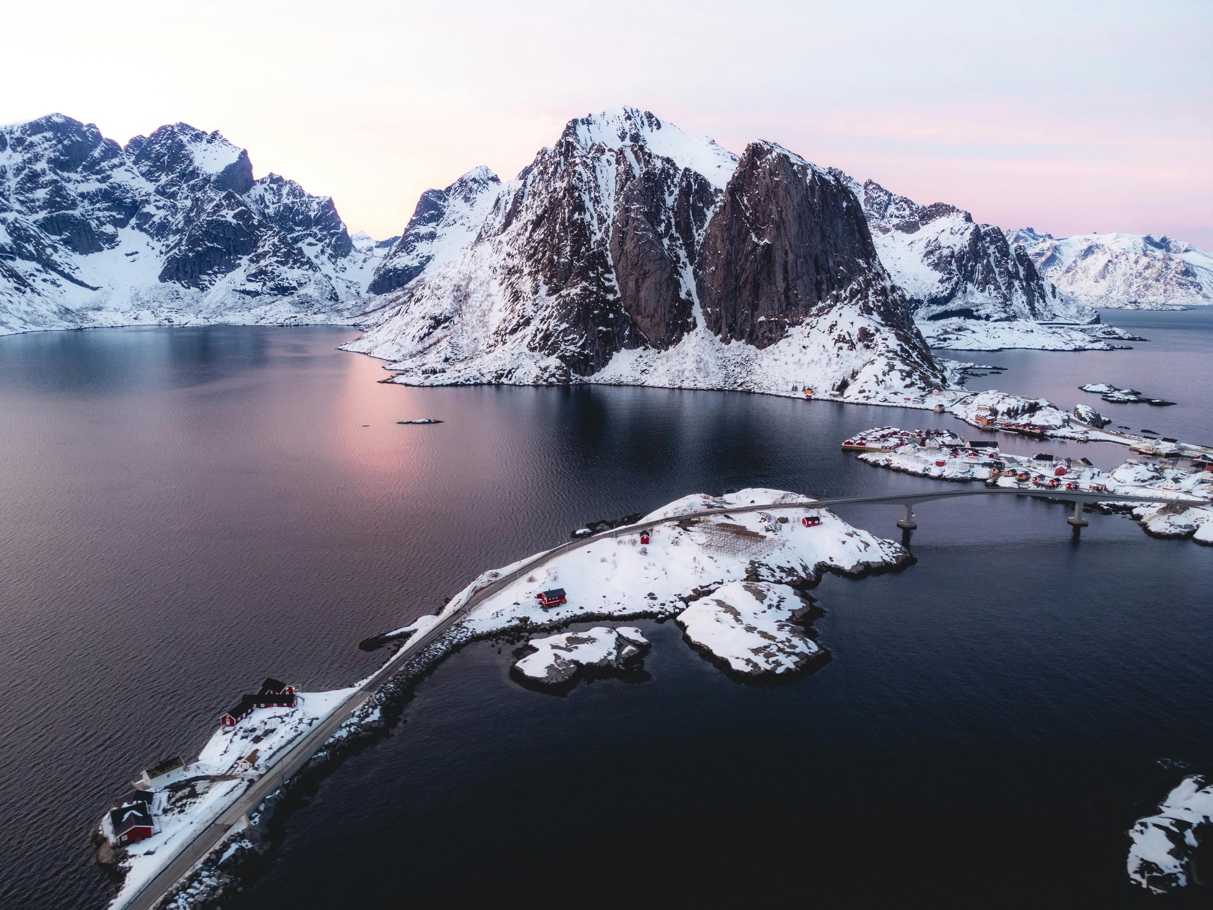
10. Mountain ranges force air upward, leading to localized heavy snowfall.
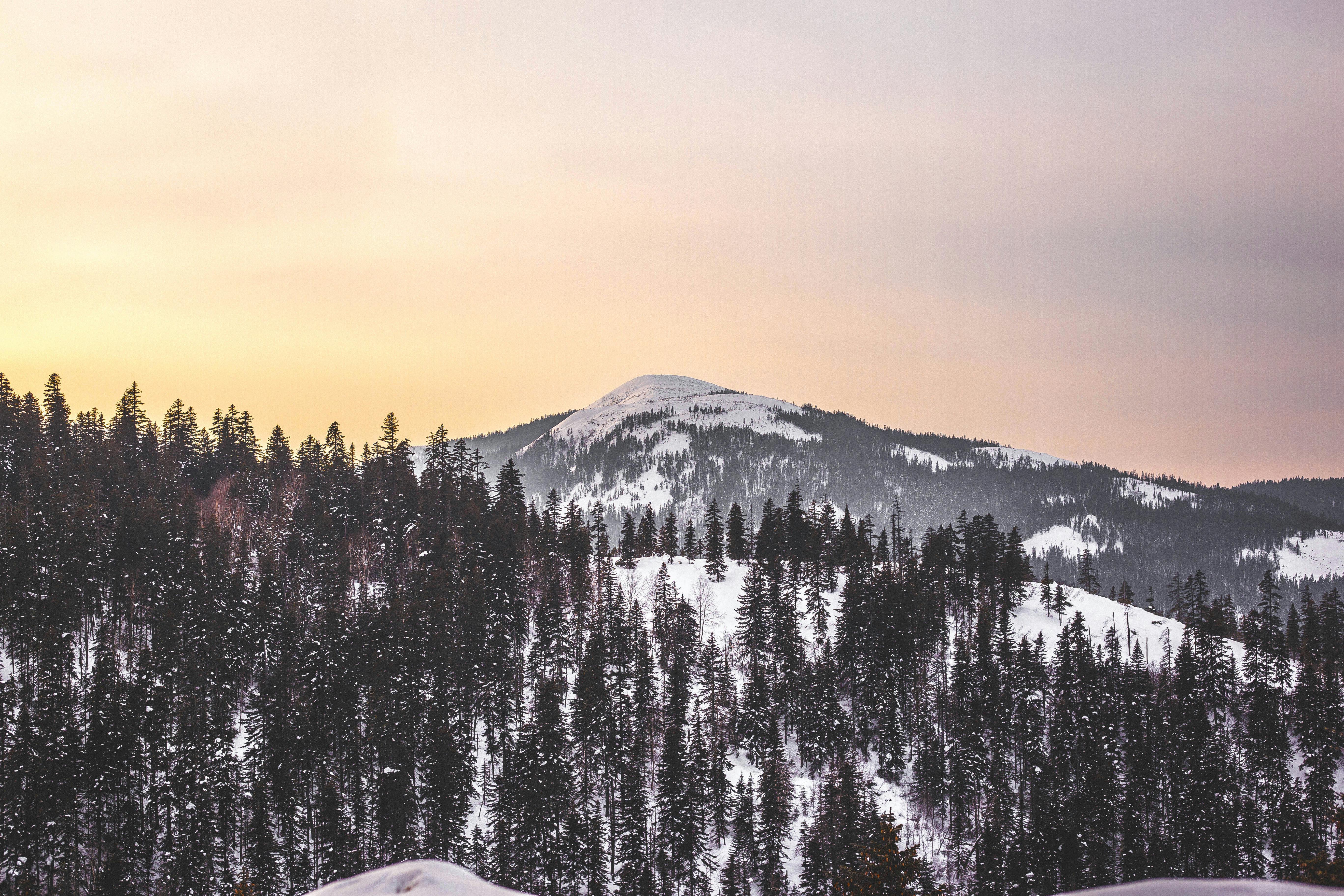
Mountain ranges influence winter weather by forcing moist air upward, causing it to cool quickly and precipitate. This orographic lift leads to heavy snowfall on windward slopes, creating a snow blanket that can persist throughout winter. Mountains act as natural barriers and significantly shape local climates.
This snowfall accumulation results in distinct weather differentiation between mountain sides, impacting ecosystems and human activities. The phenomenon demonstrates how topography directly affects precipitation patterns, illustrating variations in winter experience based solely on geographical features.
11. Sea surface temperature shifts contribute to changing precipitation behavior.

Sea surface temperature shifts affect precipitation patterns by altering atmospheric conditions above them. Warmer surface waters typically increase evaporation rates, leading to heightened rainfall or snowfall. Conversely, cooler waters suppress moisture availability, impacting local and regional precipitation rates during winter.
These temperature changes influence larger climatic cycles, affecting weather beyond coastal areas. Understanding sea surface temperatures provides insights into shifting precipitation trends, highlighting how marine environments intricately connect to terrestrial weather practices, contributing to the complexity of winter forecasting.
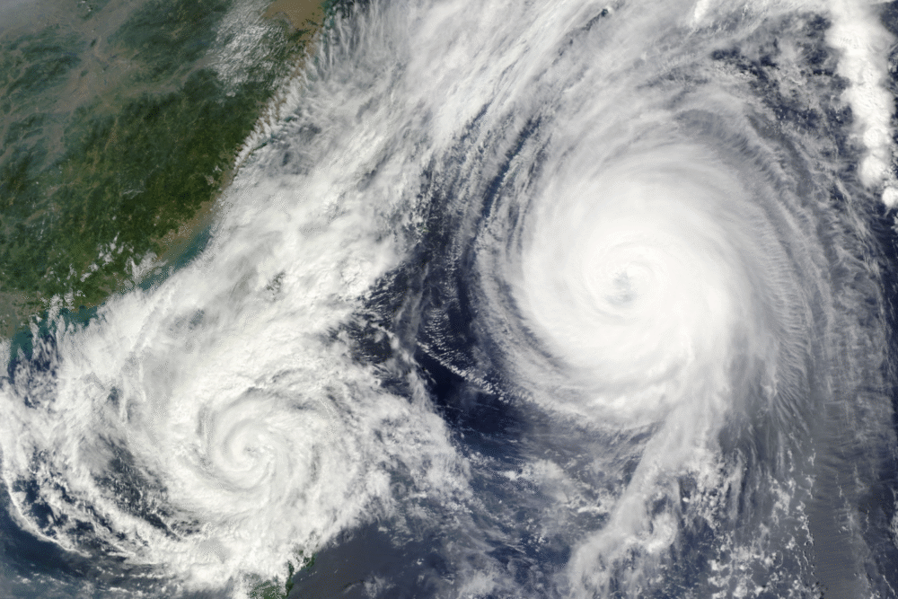
12. Atmospheric rivers transport vast moisture, causing intense winter storms.
Atmospheric rivers are narrow corridors transporting vast amounts of moisture from tropical regions to higher latitudes. These moisture-laden air streams can trigger intense winter storms when they make landfall, causing heavy rain or snowfall over affected areas along their path.
The tremendous moisture content in atmospheric rivers contributes to severe storm events capable of producing significant infrastructural and environmental impacts. Recognizing the role of these moisture pathways helps explain sudden, intense weather episodes, clarifying how atmospheric dynamics fuel extreme winter conditions unpredictably.