
A “gravity-defying” Colorado river may finally have an explanation rooted deep beneath the mountains.
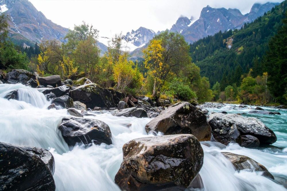
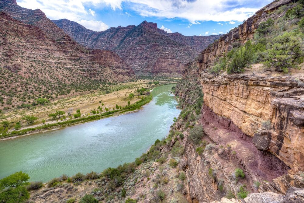
Picture a river that seems to run the wrong way, cutting straight through a mountain range as if gravity briefly stopped working. That is the long-standing mystery of the Green River, a major tributary of the Colorado River that slices across the Uinta Mountains in a route that has puzzled geologists for more than a century.
New research suggests the river never truly flowed uphill at all. Instead, a deep Earth process may have temporarily lowered the mountains themselves, allowing the river to establish its path before the landscape rebounded and rose around it. What looks impossible today may be the result of slow, hidden forces far below the surface.
1. The “uphill” mystery begins in the Uinta Mountains
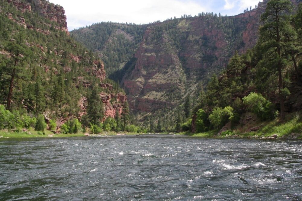
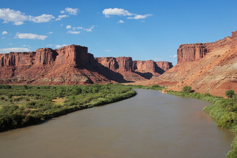
On a map, the Green River appears to do something rivers are not supposed to do. Rather than skirting the Uinta Mountains, it cuts directly across them, carving dramatic canyons where most rivers would detour.
This strange geometry is why people say the river flows uphill. The water itself always flows downhill locally, but over more than 100 miles, its overall route crosses a mountain backbone that seems like it should block it entirely. That contradiction has made the river a geological riddle for generations.
2. The river is young, but the mountains are old
One of the biggest puzzles is timing. The Uinta Mountains formed long before the Green River settled into its current course. Normally, older mountains force younger rivers to change direction.
Yet the Green River did not. That mismatch led scientists to debate whether an older river carved the route first, or whether shifting sediments or drainage patterns somehow guided the river through. None of those ideas fully matched the geological evidence, leaving the mystery unresolved.
3. A deep Earth process enters the picture
The new explanation focuses on a phenomenon called lithospheric dripping. This occurs when a dense root of rock beneath a mountain range becomes unstable and slowly sinks into the mantle.
As that heavy material drops, it can pull the surface downward. In this case, researchers suggest the Uinta Mountains may have sagged temporarily, lowering the terrain just enough for the Green River to establish a downhill path across the range.
4. Evidence hidden far below the surface
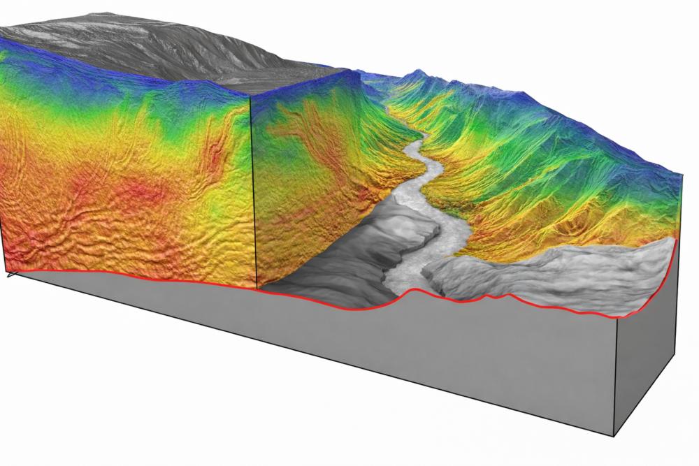
Scientists cannot directly observe lithospheric dripping, but they can detect its fingerprints. Seismic imaging beneath the region reveals signs of dense material deep underground that appears consistent with a chunk of lithosphere that detached and sank.
This matters because it provides physical support for the idea. If the crust beneath the mountains really did thin or sink, the surface above could have dropped and later rebounded, setting the stage for the river’s unusual route.
5. The mountains may have dipped, then risen again
In this scenario, the Green River never conquered the mountains. Instead, the mountains briefly lowered themselves. During that window, the river flowed downhill like any normal river.
Later, as the region rebounded and uplift resumed, the river was already locked into its course. Rather than being pushed aside, it cut downward through rising rock, carving deep canyons as the mountains grew around it.
6. Why gravity was never broken
Despite appearances, the river never violated physics. Water always flows from higher elevation to lower elevation. The illusion of an uphill river comes from comparing today’s landscape to a river path set millions of years ago.
It is similar to a road that once ran across flat land, only to have a hill slowly rise beneath it. The route stays the same, but the terrain changes. The Green River preserved a memory of an older landscape that no longer exists.
7. Canyon walls tell the story in stone
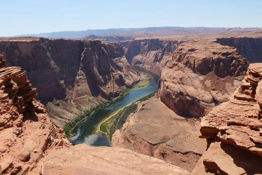
The deep gorges carved by the Green River are a key piece of evidence. Steep canyon walls suggest long-term downward cutting, exactly what you would expect if uplift occurred after the river’s path was established.
These canyons are not just scenic features. They are records of a prolonged struggle between rising rock and flowing water, written layer by layer into the landscape.
8. Why earlier explanations fell short
Previous theories relied on surface processes alone, such as inherited river paths or sediment buildup. While each explained parts of the puzzle, none could fully account for the timing and scale of the river’s crossing.
The deep Earth explanation unites multiple observations under one mechanism. It connects the river’s route to processes occurring tens of miles beneath the surface, rather than only what happens at ground level.
9. Other strange rivers may share this history
The Green River is not the only river that cuts across mountains, but it is one of the most dramatic examples. If deep Earth processes can lower and raise landscapes over millions of years, other “impossible” river routes may have similar origins.
That idea reshapes how scientists think about river networks. Landscapes are not fixed backdrops. They move, sag, and rebound, and rivers can take advantage of brief moments when the terrain is different.
10. Why this matters beyond one river
Understanding how rivers respond to uplift helps scientists reconstruct the history of continents. Where rivers cut, sediments travel. Where sediments go, ecosystems, floodplains, and groundwater systems evolve.
This kind of insight improves models of erosion and landscape change, which matter for everything from water management to understanding long-term environmental change.
11. A mystery closer to solved, but still under study

The lithospheric dripping idea offers a compelling explanation, but scientists will continue testing it with new data and improved models. Geological mysteries rarely end with a single study.
For now, the takeaway is simple. The river never flowed uphill. The Earth beneath it moved. What looks impossible today may simply be the fossilized memory of a landscape that no longer exists.