
New modeling shows how a major hurricane could flood huge sections of New York City.
New data and storm-surge modeling reveal how a powerful hurricane could push devastating amounts of water into New York City, overwhelming neighborhoods far beyond current flood zones. The New York Times analysis shows that with the right storm track, winds, tides and rising seas, parts of Manhattan, Brooklyn, Queens and the Bronx could see deep, fast-moving floodwaters. These findings highlight areas where millions live and work, raising urgent questions about infrastructure, evacuation plans and how prepared the city truly is for a future climate-driven disaster.
1. New Models Show a Strong Hurricane Could Inundate Large Parts of NYC
The NYT used updated storm-surge models to simulate how a major hurricane would affect New York City. The results show water pouring into the harbor and rushing inland along streets, subway grates and low-lying corridors. Even areas not traditionally associated with flood risk could be submerged within hours.
The modeling reflects how a combination of storm intensity, path, tide height and long-term sea-level rise could create a much more severe outcome than past storms. This reveals vulnerabilities that city planners are still struggling to address.
2. Lower Manhattan Emerges as One of the Most Exposed Areas
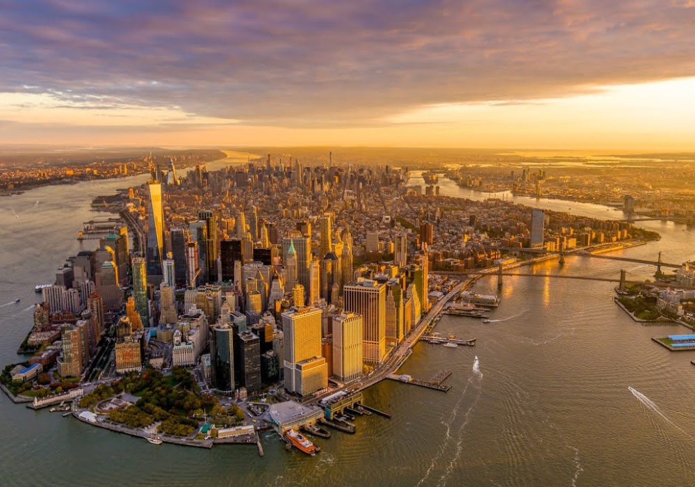
The simulation reveals that lower Manhattan is highly vulnerable to storm surge. Water could push over sea walls and bulkheads, filling streets around the Financial District, Battery Park and parts of Tribeca. The area’s low elevation leaves little buffer during an incoming storm surge.
Although protective projects are underway, including shoreline reconstruction and temporary flood barriers, many efforts are incomplete. The model demonstrates how even modest delays in these upgrades could leave dense commercial and residential areas at considerable risk.
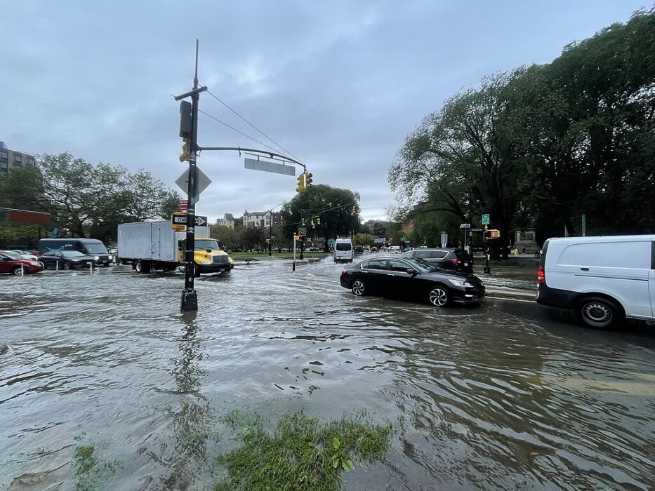
3. Brooklyn’s Coastline Could Face Rapid, Widespread Flooding
Neighborhoods along Brooklyn’s coastline, including Red Hook, Coney Island and Sheepshead Bay, show significant exposure. In the simulation, water moves quickly through channels and flat residential areas, making escape routes difficult as roads flood early.
These communities have seen repeated flood threats in past storms, but the new model shows much deeper and more extensive inundation. It suggests localized protections may be insufficient during a truly powerful hurricane, especially one tracking directly toward the city.
4. Queens Is Particularly Vulnerable Near Jamaica Bay
The model highlights large portions of Queens as high-risk flood zones, especially areas surrounding Jamaica Bay. Water could enter through multiple inlets, overwhelming marshlands and pushing deep into neighborhoods such as Howard Beach, Broad Channel and the Rockaways.
The shape of the bay helps funnel storm surge inland. Combined with rising sea levels, this creates a scenario where vast residential areas could be underwater even before a storm makes full landfall, making evacuation more challenging.
5. The Bronx and Northern Neighborhoods Are Not Immune
Although often perceived as safer from ocean flooding, parts of the Bronx are vulnerable to surge through the Long Island Sound and the Harlem River. The NYT model shows pockets of deep flooding in low-lying coastal communities, especially near waterfront developments.
These exposures challenge the idea that only southern boroughs face extreme risk. The modeling underscores how water can enter from multiple directions, creating complex flooding patterns across the region.
6. Subways and Tunnels Could Flood Much Faster Than Expected
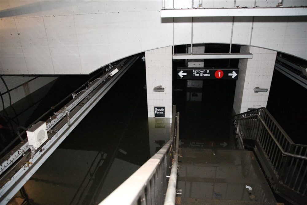
The model shows water entering subway vents, stairways and grates rapidly during a strong storm. Underground tunnels present pathways for water to travel far from the coastline. Even stations deeper inland could see flooding due to interconnected tunnel systems.
This scenario suggests that transportation systems could fail early during a major hurricane. The challenge of pumping out extensive underground networks highlights the need for upgraded protections, such as floodgates and redesigned ventilation points.
7. Sea-Level Rise Raises the Baseline Risk for Every Future Storm

The NYT analysis emphasizes that long-term sea-level rise worsens the impact of any incoming hurricane. Even a storm similar to past events becomes more destructive when the baseline water level is higher. This means protective infrastructure designed decades ago may no longer match current conditions.
As seas rise, water reaches further and stays longer, complicating emergency response. These projections suggest New York must adapt faster to keep pace with increasing environmental changes.
8. Storm Track and Timing Greatly Influence Flood Severity

The NYT models show that the exact path of a hurricane determines how water moves into the city. A slight shift west or east can dramatically change the surge pattern. The timing of the tide also affects outcomes. A high-tide landfall creates a worst-case scenario.
Understanding these variables is crucial for forecasting and emergency planning. The unpredictability of storm tracks means the city must prepare for multiple scenarios, including the most extreme ones.
9. Billions in Development Lie in Potential Flood Zones
Many parts of the waterfront have seen major development in recent decades, including expensive residential towers and large commercial projects. The simulation shows some of these zones could be among the first to flood, raising concerns about economic impacts and long-term resilience.
The findings highlight a tension between waterfront development and climate adaptation. Planners must weigh economic growth against the growing risk of destructive flooding in these areas.
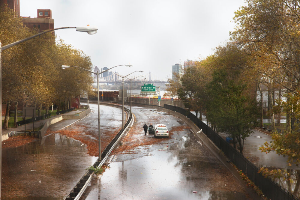
10. Emergency Evacuation Routes Face Their Own Flood Risks

The simulation shows several evacuation pathways becoming inundated early in a major hurricane. Roads intended to move people away from danger may instead become impassable, trapping residents before they can leave.
This vulnerability underscores the importance of reevaluating evacuation strategies. The city may need updated plans that account for faster-moving floodwaters and multiple points of failure, especially in coastal neighborhoods.
11. The Model Shows How Much Preparation NYC Still Needs
Overall, the NYT model reveals that New York City remains deeply vulnerable to a direct hit from a strong hurricane. While protection projects are underway, many are incomplete or limited in scope. The simulation acts as a stark reminder that the city still needs more robust defenses.
The findings are meant to help residents, planners and officials understand the scale of risk. As storms strengthen in a warming climate, the need for comprehensive protections becomes increasingly urgent.