
A 9.2 Alaska quake in 1964 sent a deadly tsunami racing down the Pacific and into U.S. coastal towns.
Just before midnight on March 27, 1964, the strongest earthquake ever recorded in North America struck southern Alaska with a magnitude of 9.2. Within minutes, a massive tsunami began racing thousands of miles down the Pacific Coast, striking Alaska, Oregon, and California without warning. Entire harbors were swept away, homes vanished beneath walls of water, and 131 people were killed—many in towns that never realized the disaster had started hundreds of miles away.
1. The Night the Earth Wouldn’t Stop Shaking
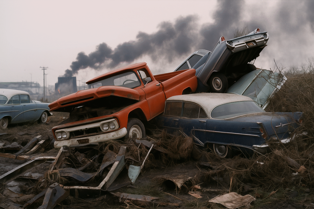
On March 27, 1964, just before midnight, southern Alaska was rocked by a 9.2-magnitude earthquake—the most powerful ever recorded in North America. The shaking lasted nearly five minutes, splitting highways, toppling buildings, and triggering massive landslides.
Residents of Anchorage described the ground rippling like waves on the ocean. Entire neighborhoods collapsed into the earth, and power lines snapped across the city. Yet even as survivors began to assess the damage, few realized that the earthquake had also displaced billions of tons of seawater—setting off a chain of destruction far beyond Alaska.
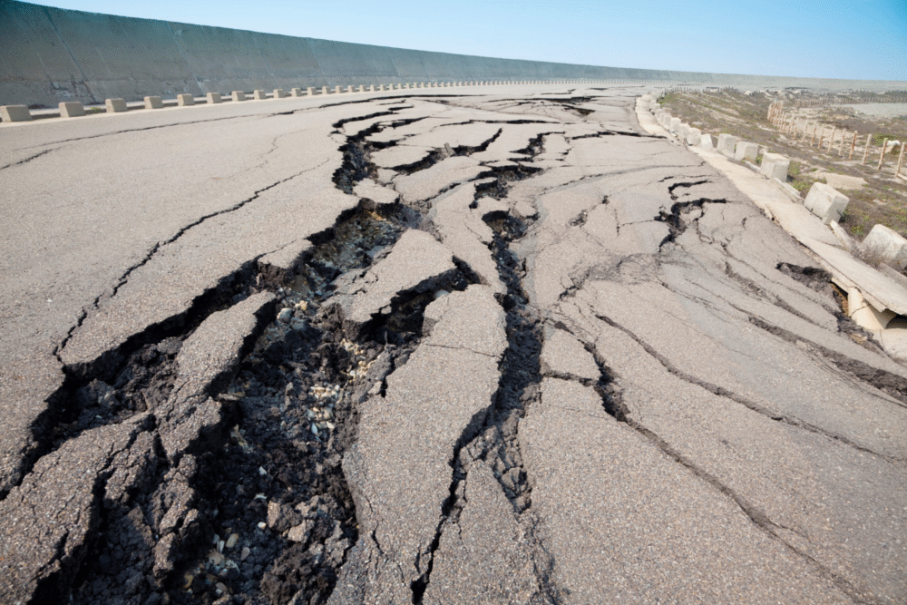
2. A Quake So Strong It Reshaped the Land
The force of the quake permanently altered Alaska’s geography. Parts of the coast rose by as much as 30 feet, while others sank below sea level. Entire forests were flooded, turning into eerie “ghost trees” standing in saltwater swamps.
The massive energy release came from a fault line deep beneath the Prince William Sound region, where the Pacific Plate dives under the North American Plate. That collision set off vibrations felt across half the planet, shaking buildings in Seattle, San Francisco, and even Baton Rouge, Louisiana.
3. The Hidden Danger Beneath the Waves
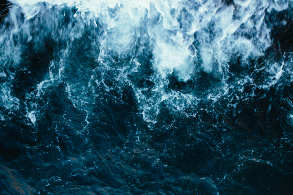
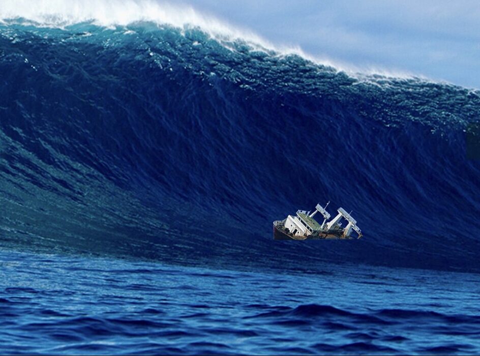
As the ground convulsed, the ocean above it heaved upward, creating a surge of displaced water. Within minutes, massive waves began forming in the Gulf of Alaska. Some were local tsunamis caused by underwater landslides; others spread outward across the Pacific.
Scientists estimate that the waves reached speeds of more than 400 miles per hour. They raced silently toward coastal towns and fishing ports—places already reeling from earthquake damage—where residents had no idea that something even more devastating was on its way.
4. Valdez and Seward: The First to Be Hit
The first tsunami waves struck the Alaskan ports of Valdez and Seward just minutes after the quake. In Valdez, a section of the harbor collapsed into the sea, sending docks, trucks, and oil tanks crashing into the water. The waves that followed swept through town, flattening buildings and killing 30 people.
In Seward, fuel storage tanks exploded as the tsunami ignited a wall of fire that moved across the water. The combined effect of fire and flood left the once-bustling harbor in ruins—a preview of what awaited other communities farther south.
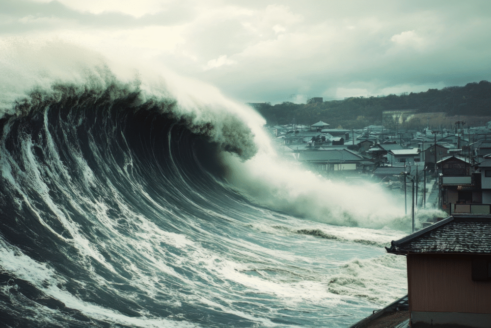
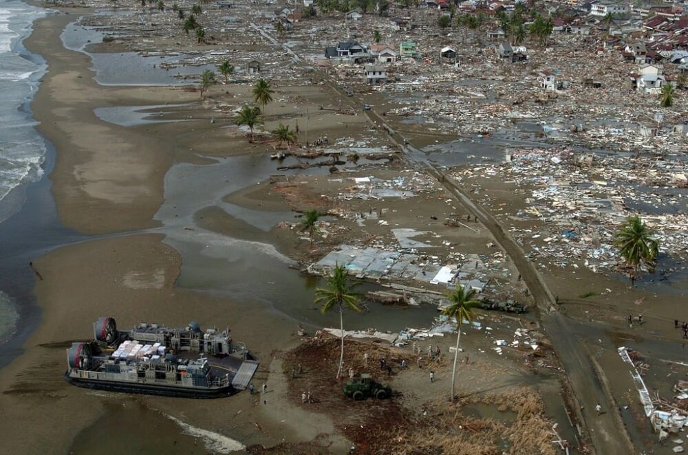
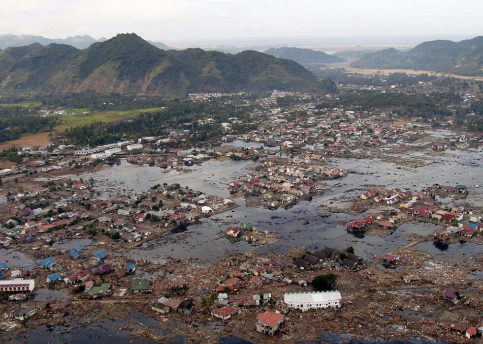
5. The Tsunami Raced Down the Pacific Coast
Within hours, the tsunami began striking coastal areas thousands of miles away. Kodiak Island reported waves over 30 feet high. As the surge traveled south, it maintained deadly strength, funneling into narrow bays and amplifying in height.
By the time the waves reached British Columbia, Washington, Oregon, and California, it was early morning. Many residents, unaware of the danger, had no warning to evacuate. Fishing boats were tossed onto highways, and small seaside towns awoke to walls of water that seemed to appear out of nowhere.
6. Crescent City’s Night of Horror
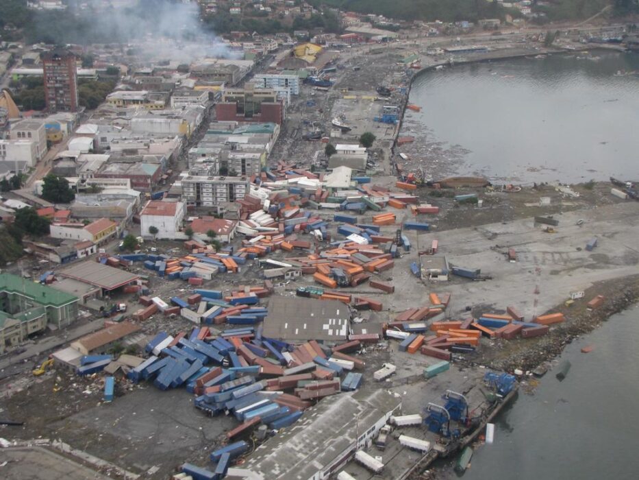
Crescent City, California, became the most tragic example of the tsunami’s power. Just before midnight on March 28—over four hours after the earthquake—waves more than 20 feet high struck the harbor. The first few surges were small enough to draw curious onlookers downtown.
Then a massive wave slammed into the coast, destroying 29 city blocks and sweeping cars, homes, and people into the sea. Eleven residents were killed, and hundreds were injured. To this day, Crescent City remains one of the hardest-hit U.S. communities by a distant tsunami.
7. Ignored Warnings and Delayed Alerts
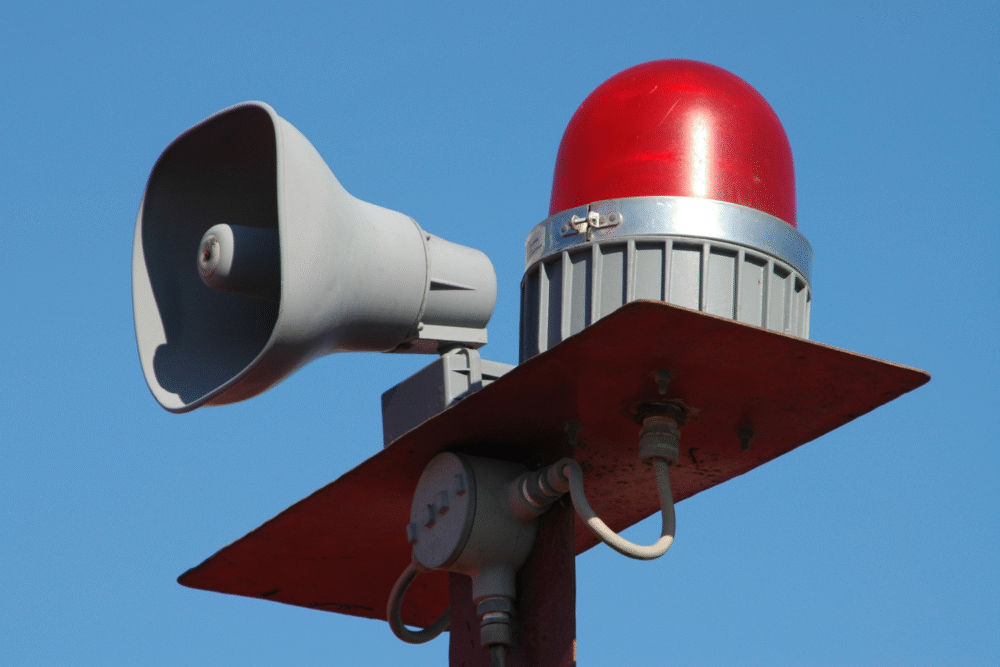
At the time, the U.S. lacked an effective tsunami warning system. A few scientists in Honolulu detected unusual ocean activity after the Alaska quake, but communication delays meant many coastal communities never got the message in time.
In 1964, there were no smartphones, automated alerts, or satellite monitoring systems. Warnings relied on phone calls and teletype messages sent manually. By the time alerts reached California, the waves had already struck. The disaster exposed how unprepared the country was for ocean-based threats that could travel thousands of miles in hours.
8. The Science Was Still Catching Up
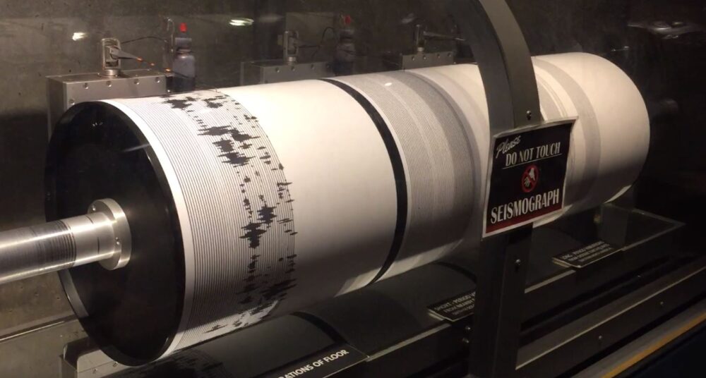
Before 1964, scientists understood earthquakes but not how they triggered tsunamis across oceans. The Alaska event changed that. Seismologists realized that subduction zones—where one tectonic plate slides under another—could generate both massive quakes and far-reaching tsunami waves.
This discovery reshaped how experts modeled coastal risk. Researchers began developing mathematical simulations to predict wave speed, height, and impact. The data collected from 1964 became the foundation for today’s global tsunami forecasting network, which now monitors seismic events around the clock.
9. Lives Lost and Lessons Learned
The 1964 Alaska earthquake and tsunami killed 131 people in total, including 12 in California and 5 in Oregon. Many victims were found miles inland, carried by waves that tore through harbors and neighborhoods.
In the aftermath, the federal government launched an investigation into tsunami response and emergency communication. Out of that inquiry came a nationwide effort to create coastal evacuation routes, install sirens, and fund the Pacific Tsunami Warning Center—steps that have saved countless lives since.
10. Communities That Never Fully Recovered

Entire Alaskan towns, including Valdez and Chenega, were so devastated that they were rebuilt in new locations. Residents lost not only homes but entire histories—their schools, fishing industries, and landmarks wiped away in minutes.
Crescent City eventually rebuilt, but reminders of that night remain. Markers on buildings show how high the waves reached, and each March, residents hold a ceremony to remember those who died. The city’s harbor has since been rebuilt with stronger defenses—but it has been hit by tsunamis multiple times since, including one in 2011.
11. How the Disaster Changed Tsunami Preparedness

The Alaska tsunami was a turning point in coastal safety. In its wake, scientists developed new seafloor sensors, wave buoys, and global alert systems that can detect tsunamis within minutes of an undersea quake.
Today, emergency managers use those tools to issue alerts across the Pacific within seconds. Schools in coastal towns practice evacuation drills, and hazard maps identify danger zones. The lessons learned in 1964 continue to shape disaster readiness, ensuring that history doesn’t repeat itself.
12. The Lasting Legacy of 1964
More than sixty years later, the 1964 Alaska earthquake remains one of the most studied natural disasters in history. Its waves changed coastlines, its data changed science, and its losses changed policy.
It also reminded Americans that nature’s most powerful forces don’t always strike where we expect. The disaster linked distant communities across the Pacific in tragedy—and in determination to be better prepared. Every coastal warning siren that sounds today echoes lessons learned from that fateful night when the ocean turned against the shore.