
Fueled by record-warm Atlantic waters, Hurricane Melissa shows how climate change is supercharging storms.
In just 36 hours, Hurricane Melissa exploded from a Category 2 to a Category 5 monster — one of the fastest intensifications ever recorded in the Atlantic. Scientists say the cause is clear: ocean temperatures that are several degrees above normal are feeding storms far more energy than in the past. As Melissa barrels toward the Caribbean with record wind speeds, experts warn it’s a preview of what a hotter, wetter planet could bring in the decades ahead.
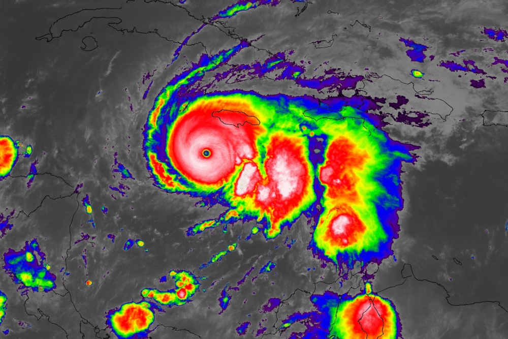
1. A Record-Breaking Storm Formed Over Unusually Warm Seas

Hurricane Melissa began as a relatively weak tropical system before encountering Atlantic waters that were several degrees warmer than average. Sea surface temperatures topping 86°F (30°C) provided the perfect fuel for rapid intensification.
Meteorologists noted that the Atlantic’s heat content this season is among the highest ever recorded. That surplus energy allowed the storm to strengthen with stunning speed—demonstrating how a warmer ocean can transform a routine storm into a major disaster in a matter of hours.
2. Rapid Intensification Took Experts by Surprise
Within just a day and a half, Melissa exploded from a Category 2 storm into a Category 5 hurricane. This rate of intensification, while not unprecedented, has become increasingly common as ocean heat accumulates.
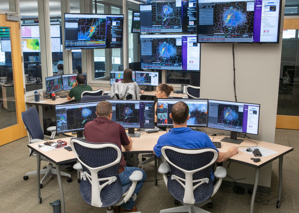
Meteorologists say that such rapid escalation gives coastal communities less time to prepare and evacuate. Forecast models captured the broad trend but still underestimated the storm’s speed, underscoring the challenges of predicting next-generation superstorms in a warming climate.
3. Ocean Heat Is Now the Engine Behind Stronger Hurricanes

Climate scientists have long warned that rising sea temperatures would make hurricanes more intense. Warmer water increases evaporation, which supplies more latent heat—the energy hurricanes feed on.
In the case of Melissa, that process was supercharged. The storm drew immense amounts of moisture from the ocean, boosting its power and expanding its wind field. The same mechanism has driven recent storms like Dorian and Ian, reinforcing the link between ocean warming and hurricane strength.
4. The Storm’s Size Amplified Its Destructive Potential
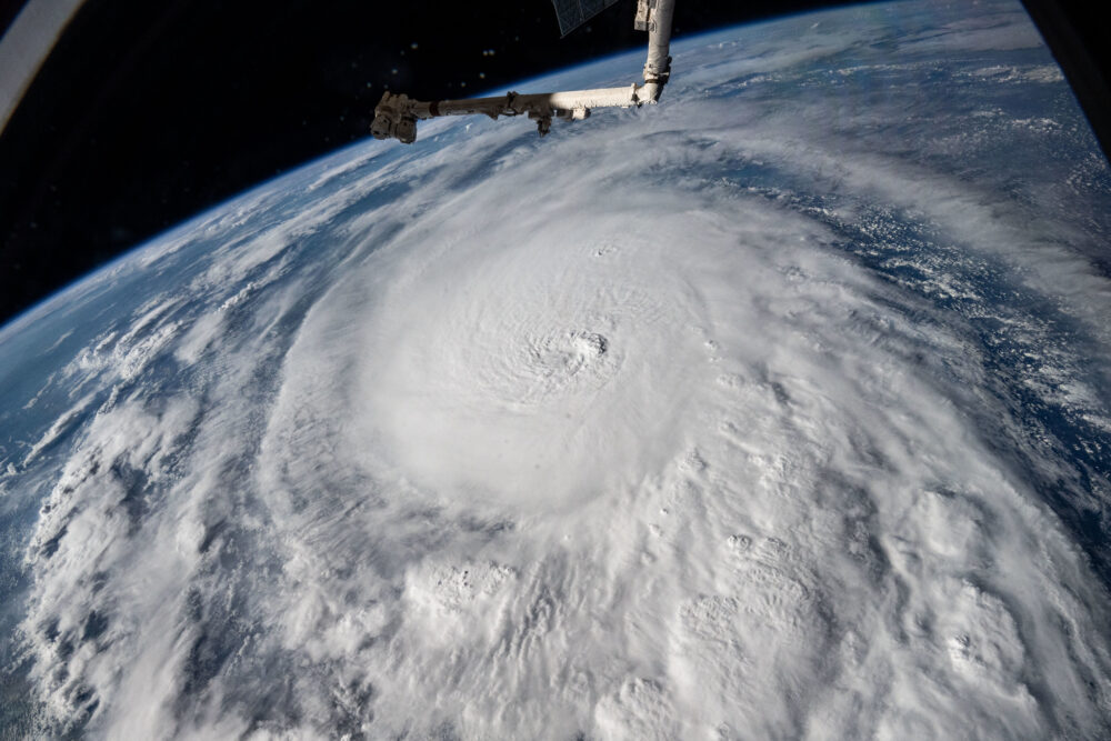
Melissa’s power wasn’t only about wind speed—it was also about scale. The storm grew in diameter as it intensified, extending hurricane-force winds hundreds of miles from the eye.
Larger storms push more seawater toward coastlines, causing greater storm surges and inland flooding. Even areas far from Melissa’s direct path could experience dangerous waves and heavy rainfall, showing how warming oceans are not only fueling stronger storms but also wider ones.
5. Jamaica and the Caribbean Faced the First Major Impacts

As Melissa tracked westward, Jamaica braced for direct landfall. Torrential rains, sustained winds exceeding 160 mph, and life-threatening storm surges battered the island. Emergency services were quickly overwhelmed by flash floods and power outages.
Neighboring countries, including the Cayman Islands and parts of Cuba, also faced damaging conditions. Early reports suggested extensive coastal erosion and infrastructure damage, further evidence that small island nations remain on the front lines of climate-fueled disasters.
6. Scientists See a Clear Climate Fingerprint

Researchers analyzing Melissa’s formation point to unmistakable signs of human-driven climate change. The North Atlantic has absorbed roughly 90 percent of the excess heat trapped by greenhouse gases, creating ideal conditions for explosive storm growth.
While climate change doesn’t create hurricanes, it makes them more destructive. A warmer atmosphere holds more moisture, which intensifies rainfall. Combined with hotter seas, these ingredients have made storms like Melissa both more powerful and more unpredictable than their 20th-century counterparts.
7. Rapid Intensification Is Becoming the New Normal

According to NOAA data, the number of Atlantic storms undergoing “rapid intensification”—a jump of at least 35 mph in 24 hours—has more than doubled since the 1980s. Melissa is the latest and most dramatic example of this trend.
This acceleration means that coastal communities can no longer rely on days of advance notice to prepare. Scientists say improving real-time ocean monitoring and satellite-based temperature mapping will be critical to forecasting the next Melissa-level event.
8. Economic and Human Costs Are Rising Sharply

Even before Melissa’s final landfall, economic losses across the Caribbean were estimated in the billions. Power grids, tourism infrastructure, and agriculture suffered heavy damage.
Beyond property losses, the human toll is significant. Thousands were displaced, and relief efforts are struggling to keep pace with rising storm intensity. Economists warn that as climate-fueled storms grow stronger, recovery costs will outstrip the budgets of many vulnerable nations.
9. A Warning for the Atlantic Hurricane Season Ahead

Melissa’s explosive growth serves as an early warning for the remainder of the hurricane season. Meteorologists caution that with ocean temperatures remaining at record highs, similar storms could develop well into late autumn.
Experts urge preparedness measures that include stronger evacuation planning, improved flood defenses, and early disaster financing. If current trends continue, the Atlantic basin may face more frequent Category 4 and 5 hurricanes than at any point in recorded history.
10. Melissa May Be a Glimpse of the Future

To climate scientists, Hurricane Melissa represents a glimpse of what lies ahead if global warming continues unchecked. Stronger storms, faster intensification, and higher storm surges are all projected outcomes of a warmer world.
The storm’s ferocity underscores the urgency of cutting greenhouse gas emissions and investing in coastal resilience. While Melissa will eventually dissipate, the conditions that created it are not going away—making this hurricane less an anomaly and more a harbinger of the planet’s new normal.