
Scientists say a perfect storm of heat, terrain, and timing is making flash floods far more dangerous.
They strike with little warning — rivers that surge from calm streams to roaring torrents in just a few hours. Across the world, flash floods are becoming more frequent and more violent, fueled by extreme rainfall and warming temperatures. But scientists warn there’s more to the story than heavy rain. Subtle factors like soil saturation, steep terrain, and even wildfire scars can set the stage for sudden disaster. When those forces align, water races downhill with explosive power, overwhelming communities before they can react. Understanding this hidden setup may be the key to saving lives.
1. When Rivers Turn Deadly in Hours

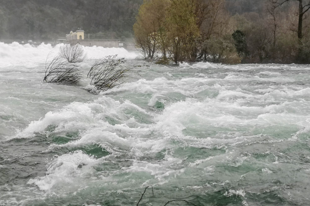
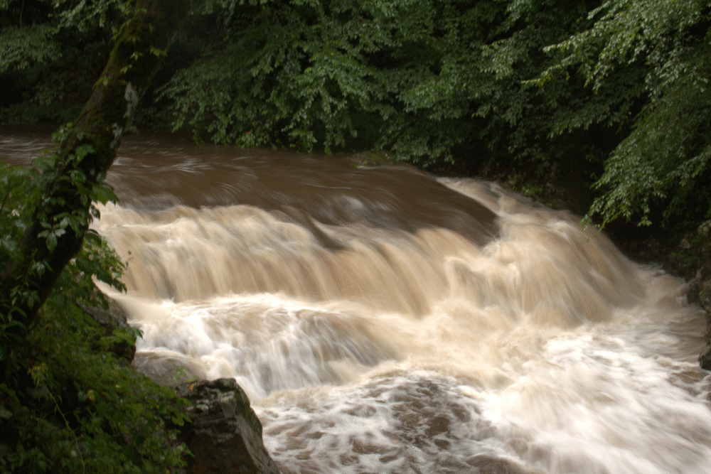
Flash floods are among the most dangerous natural disasters because they unfold with astonishing speed. A calm river can swell into a raging torrent in just a few hours, leaving little time for warnings or evacuations. Unlike seasonal flooding, these events are often triggered by short, intense bursts of rain that overwhelm natural drainage systems.
Scientists say flash floods are now increasing worldwide due to warmer air holding more moisture. The result is sudden downpours that release massive amounts of water in minutes — a recipe for disaster in vulnerable landscapes.
2. The Hidden Triggers Behind Flash Floods

While heavy rain is the obvious culprit, it’s rarely the only one. Factors like parched soil, urban pavement, and steep topography all influence how fast water flows into rivers and streams. When the ground can’t absorb rainfall, runoff rushes downhill and pools in low-lying areas.
In regions recently scorched by wildfire, the danger is even higher. Burned soil becomes water-repellent, turning hillsides into slick, impermeable slides. Scientists say this “hydrophobic soil effect” can magnify flood intensity even when rainfall totals seem moderate.
3. Why Flash Floods Are Getting Worse
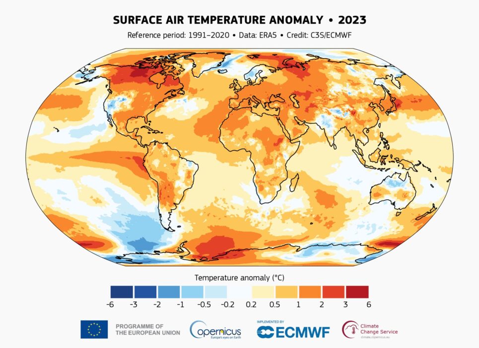
Climate change is amplifying the conditions that create flash floods. Rising global temperatures increase evaporation, adding more water vapor to the atmosphere. That extra moisture turns ordinary storms into deluges, dumping several months’ worth of rain in a single afternoon.
At the same time, expanding cities replace natural wetlands and forests with asphalt, eliminating the earth’s natural ability to soak up excess water. Scientists say this combination — heavier rain and less absorption — is turning once-rare flash floods into regular, deadly events.
4. How Topography Turns Rain Into Disaster
Some landscapes are naturally more prone to flash flooding. Narrow valleys, steep canyons, and mountainous terrain funnel rainfall into concentrated streams, increasing the water’s speed and force. When storms linger over these features, runoff channels converge into dangerous surges.
Even small rivers in high-gradient regions can rise by 10 feet or more in under an hour. Hydrologists call these “responding basins,” meaning they react instantly to rainfall. In such areas, one thunderstorm can unleash a wall of water powerful enough to uproot trees, destroy bridges, and sweep away vehicles.
5. The Role of “Rain-on-Snow” Events
A lesser-known but increasingly common trigger for flash floods is the “rain-on-snow” phenomenon. When warm rain falls on snowpack, it accelerates melting and sends torrents of water racing downhill. This dual influx — rain plus snowmelt — can overwhelm rivers and dams that appear stable just hours earlier.
Recent studies in the western U.S. and Europe show these events are becoming more frequent as winters grow warmer and storms more erratic. The result is a hidden flood threat that can strike mountain towns long before traditional spring melt season begins.
6. When Urban Areas Become Flood Traps
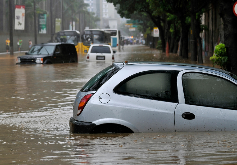
Cities are especially vulnerable to flash floods because pavement, concrete, and rooftops prevent water from soaking into the ground. Instead, it rushes toward storm drains that can’t handle the sudden volume, flooding streets within minutes.
Even modest rainfall can turn deadly when drainage systems clog or overflow. In densely built areas, the “impermeable surface effect” amplifies flood risk — one of the reasons city planners are racing to create green spaces, retention ponds, and permeable pavements to absorb excess runoff.
7. The Deadly Lag Between Warning and Reality

Meteorologists can now predict where flash floods might occur, but precise timing remains elusive. Rainfall intensity, topography, and local drainage interact in complex ways, making each event unique.
By the time rivers begin to swell, evacuation windows may have already closed. Scientists are working on real-time flood forecasting systems that use radar, satellite data, and AI modeling to narrow that warning gap. But for now, the most effective defense is community awareness — knowing where the risks lie before the rain begins.
8. Lessons From Recent Flash Flood Disasters

From Kentucky and Vermont to Libya and Pakistan, flash floods have devastated entire regions in just hours. In nearly every case, scientists found that the setup was visible days in advance — yet underappreciated. Dry soils, steep valleys, and poor infrastructure combined to magnify each storm’s impact.
Post-disaster analyses show that local geography and land use often determine the scale of destruction. Communities built on floodplains or near narrow drainage channels face the highest risk, especially when storms stall and release multiple inches of rain in one location.
9. The Science of Predicting Flash Floods

Researchers are now using high-resolution climate models and radar data to simulate how storms translate into runoff. These tools can identify “flash flood hot zones” — areas where terrain and rainfall patterns make disaster more likely.
In some regions, scientists are also testing soil-moisture sensors that detect when the ground can no longer absorb water. When combined with rainfall forecasts, these data points could provide life-saving hours of advance notice, especially in mountain towns and urban basins where floods develop fastest.
10. Preparing for the Next Sudden Surge

Experts say the key to surviving flash floods is preparation, not reaction. That means identifying flood-prone zones, improving early-warning systems, and designing infrastructure that channels water safely away from homes.
Simple measures — like maintaining drainage systems, avoiding construction in floodplains, and creating natural buffers — can dramatically reduce losses. As climate extremes intensify, scientists warn that the next deadly flash flood won’t be a surprise; it will be a predictable outcome of conditions we can already see forming today.