
Forecasters warn that multiple Pacific storms could bring flooding, strong winds, and mountain snow to the West.
A powerful train of Pacific storms is set to drench the western United States this week, bringing heavy rain, gusty winds, and flooding concerns from Washington to California. Meteorologists say several back-to-back systems will funnel moisture inland, creating an atmospheric river that could drop 2 to 6 inches of rain in some areas. Burn scars and low-lying regions face the greatest flood risk, while mountain passes may see significant snowfall and dangerous travel conditions through the weekend.
1. A Train of Pacific Storms Is Lining Up to Hit the West

Meteorologists are tracking a series of low-pressure systems forming over the Pacific Ocean, set to move inland one after another. This pattern, known as a “storm train,” funnels continuous moisture toward the western United States.
Forecasters say this setup will bring several days of unsettled weather across coastal and mountain regions, with little time for the ground to dry between systems—raising the risk of flooding, landslides, and travel disruptions.
2. Atmospheric River to Bring a Surge of Moisture Inland
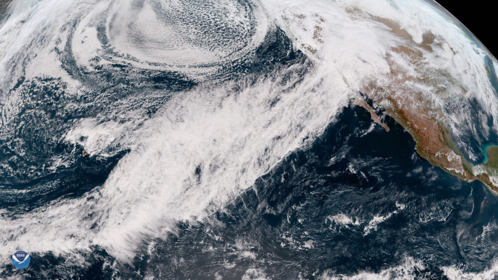
The storms are being fueled by an atmospheric river—a narrow band of moisture in the atmosphere that carries water vapor from the tropics to higher latitudes. When this moisture hits the mountains of the West, it releases heavy rain and snow.
Forecasters expect this week’s atmospheric river to reach moderate strength, delivering widespread precipitation to northern and central California, Oregon, and Washington by midweek.
3. Rainfall Totals Could Reach Flood Levels in Some Areas

According to the National Weather Service, parts of western Oregon and northern California could receive 2 to 6 inches of rain through the weekend. Localized rainfall totals could exceed that amount in coastal ranges and foothills.
Urban areas with poor drainage, as well as burn scars left by wildfires, are most at risk for flash flooding and debris flows. Officials are urging residents to monitor flood alerts and prepare for potential evacuation orders.
4. Strong Winds May Knock Out Power and Down Trees

In addition to heavy rainfall, powerful gusts are expected along the Pacific Coast and through mountain passes. Wind speeds could reach 40 to 60 miles per hour in exposed areas, with isolated gusts over 70 mph along ridgelines.
These winds could topple trees in saturated soil and cause power outages. Utility crews across California and Oregon are on alert for downed lines and service interruptions as the storm series intensifies.
5. Heavy Snow Will Blanket the Sierra Nevada and Cascades

While rain will dominate lower elevations, colder air at higher altitudes will produce significant snowfall across the Sierra Nevada, the Cascades, and parts of the Rockies. Forecasters expect accumulations of 1 to 3 feet in some mountain zones.
This snow will improve regional snowpack levels—vital for spring water supplies—but will also make travel dangerous. Chains may be required on major routes like Interstate 80 over Donner Pass and Highway 50 near Lake Tahoe.
6. Urban Flooding a Concern for Coastal Cities

Cities such as San Francisco, Portland, and Seattle are expected to see repeated bouts of heavy rain over the coming days. With short breaks between systems, storm drains may quickly back up, leading to ponding on roadways and minor urban flooding.
Local emergency officials advise avoiding flooded intersections, where just a few inches of water can disable a vehicle or cause loss of control. Public works crews are clearing drains and distributing sandbags ahead of the storms.
7. Burn Scar Areas Face Elevated Mudslide Risk
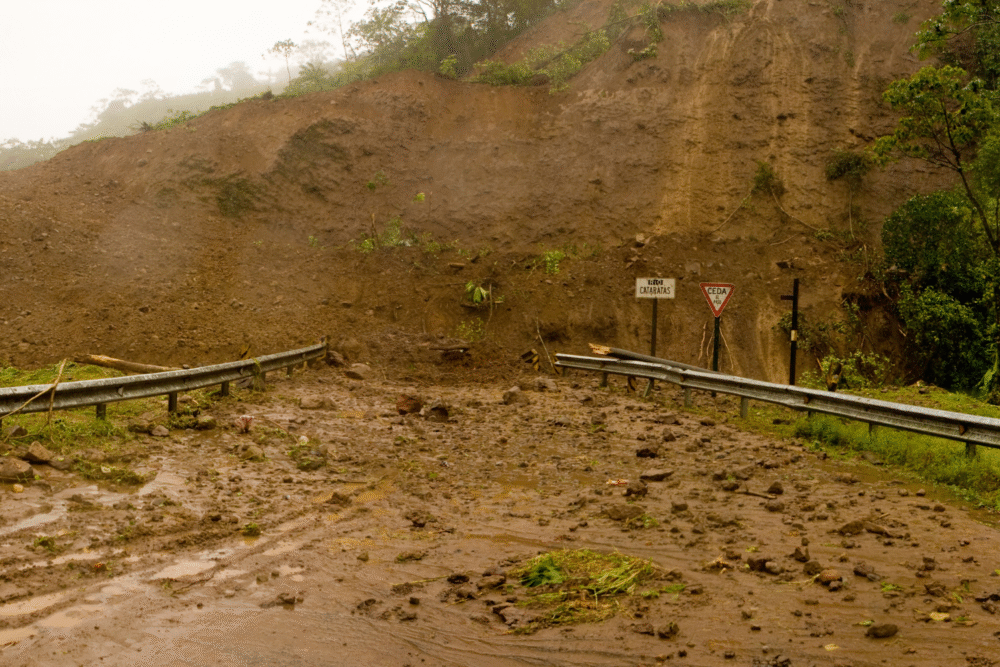
Regions recently affected by wildfires—such as parts of northern California and southern Oregon—remain especially vulnerable. When intense rain falls on scorched ground, the soil cannot absorb moisture, leading to flash floods and debris flows.
The National Weather Service warns that even moderate rain rates can trigger dangerous conditions in these areas. Residents near burn scars should prepare emergency kits and follow any local evacuation orders.
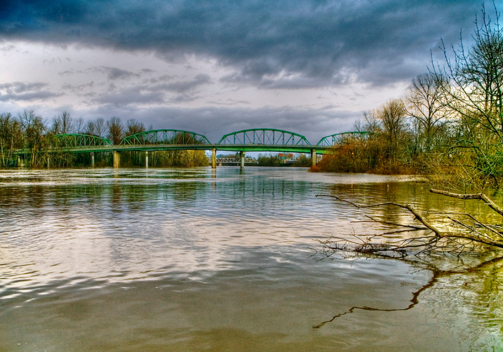
8. Successive Storms Could Saturate the Ground and Rivers

With several storm systems arriving in rapid succession, much of the West’s soil will have little chance to dry out between downpours. Hydrologists caution that this saturation effect can cause smaller creeks and rivers to overflow more easily.
In northern California and western Oregon, rising river levels are already being monitored closely. Even if individual storms are moderate, their cumulative impact could lead to widespread runoff and localized flooding by week’s end.
9. The Storm Train Will Gradually Shift South Over the Weekend

While early storms will mainly hit the Pacific Northwest, later systems are expected to dip farther south toward central and southern California. Forecasters say Los Angeles and San Diego could see periods of rain by the weekend.
Although rainfall totals there will be lighter, any moisture adds to seasonal precipitation that helps alleviate drought conditions. However, localized flooding could still occur in desert areas where dry soil resists quick absorption.
10. Forecasters Urge Caution but Note Long-Term Benefits
Despite short-term hazards, meteorologists emphasize that these storms also bring much-needed water to reservoirs and snowpack crucial for the western water supply. The challenge is balancing flood management with long-term resource gains.
Experts say the key message is preparedness: secure outdoor items, avoid flooded roads, and stay updated on forecasts. For much of the West, this week’s storm train will be both a temporary threat—and an essential source of relief.