
Climate scientists warn that merging storm tracks could trigger more extreme weather events across the U.S.

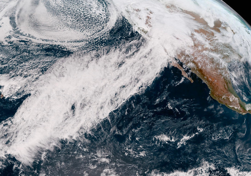
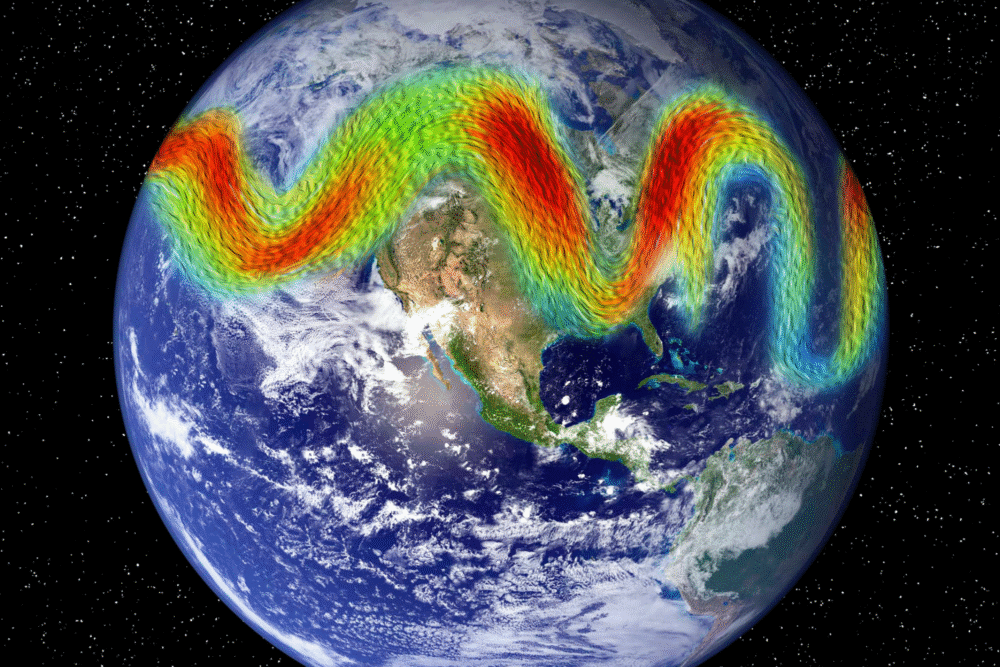
Meteorologists are sounding the alarm over a potential clash of U.S. weather systems: the Pacific and Atlantic storm tracks may be moving toward each other, creating powerful new storm dynamics.
Dr. Jennifer Francis, a senior atmospheric scientist at the Woodwell Climate Research Center, explains that “the Arctic is warming much faster than anywhere else on Earth”, which disrupts the jet stream and leads to slower, more meandering weather patterns—paving the way for storms to merge and intensify. If this trend continues, we may be entering a new era of atmospheric instability driven by climate change—far beyond the predictable storms of the past.
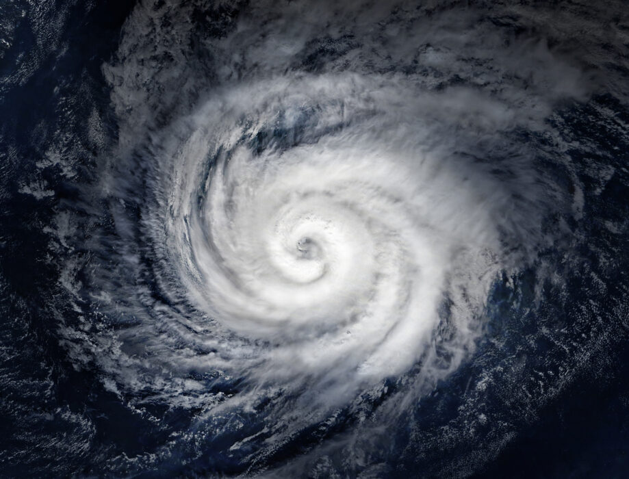
1. A merged storm track could mean bigger, more destructive storms across the U.S.

When two storm tracks interact, they can combine their moisture and energy to form massive superstorms. This convergence creates a dangerous synergy, allowing storm systems to grow faster and dump more precipitation than usual. Think of it like two rivers joining—only with wind, rain, and chaos.
In the past, large storm systems have already overwhelmed cities and rural areas alike. If these tracks merge regularly, we may see record-setting rainfall, hurricane-like winds, and snowfall events that paralyze infrastructure. This isn’t just bad weather—it’s a threat to public safety, agriculture, and the economy on a national scale.
2. Merging storm paths could shift rainfall patterns and increase flooding risks.

If storm tracks combine, regions that once had predictable rainy seasons could see extreme downpours at unexpected times. The Southeast and Midwest, in particular, may experience more frequent flash floods and overflowing rivers. Cities with aging infrastructure—storm drains, levees, and dams—won’t be able to handle the volume.
Meanwhile, other areas might experience longer droughts, followed by sudden deluges, which worsen soil erosion and water pollution. This imbalance hurts farmers and threatens food supply chains. With climate change adding heat and moisture to the atmosphere, storms that were once seasonal could now arrive unannounced and overstayed.
3. The collision of storm tracks could lead to colder winters in some areas.
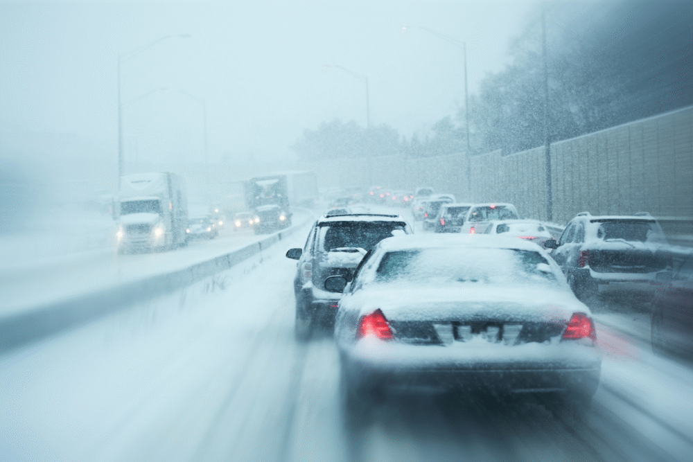
While climate change is generally warming the planet, merging storm tracks could ironically bring more Arctic air to the lower 48. When a deep trough in the jet stream forms, frigid polar air can dip far south, creating brutal cold snaps. If these systems link up with moisture from a secondary storm track, they can create snowstorms that rival historic blizzards.
That’s why some regions might face both record cold and record snowfall—even as the planet continues warming. It’s a reminder that climate change doesn’t always mean mild winters; it often means more erratic, extreme, and dangerous winter weather.
4. More powerful nor’easters may slam the East Coast more often.
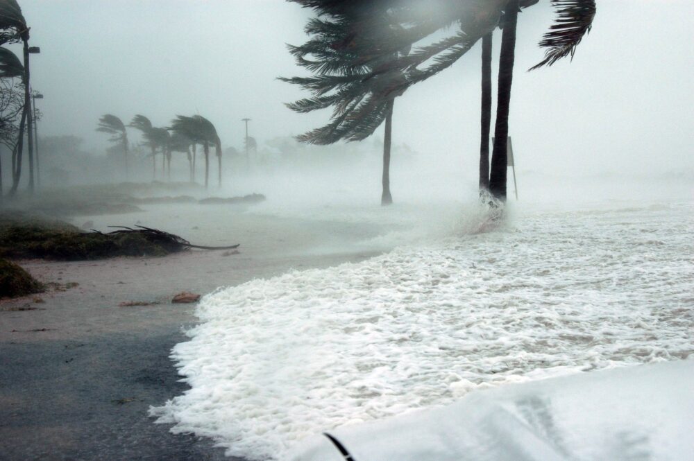
Nor’easters thrive on the energy created when cold Arctic air meets warm Atlantic moisture. If storm tracks merge, that dynamic collision could become more common. This means major coastal storms—complete with flooding, snow, and high winds—may occur more frequently along the Eastern Seaboard. Cities like Boston, New York, and Philadelphia could see more transportation shutdowns, power outages, and costly cleanup efforts.
Plus, rising sea levels make storm surges from these nor’easters even more damaging. If the atmospheric setup favors these mega-systems more often, they could redefine what “winter weather” means for tens of millions of Americans.
5. The U.S. West could face stronger atmospheric river events.
The Pacific storm track already feeds powerful “atmospheric rivers”—narrow bands of moisture that drench the West Coast. But if storm tracks merge or shift, these events could become more frequent and intense. California, in particular, might face weeks-long rain events that overwhelm reservoirs, flood valleys, and destabilize hillsides.
These storms are capable of dropping feet of snow in the Sierras and filling rivers to the brim. While the state needs precipitation, these supercharged systems deliver it in destructive bursts. And once the snow melts rapidly in spring, it can lead to more downstream flooding and infrastructure damage.
6. Tornado season could become longer and harder to predict.
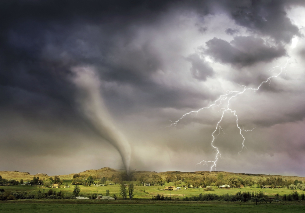
Tornadoes thrive when warm, moist air collides with cold, dry air—a setup often provided by overlapping storm tracks. If a merger intensifies this contrast across the central U.S., the result could be more frequent and widespread tornado outbreaks. Areas like Oklahoma, Kansas, and even parts of the Southeast might see their traditional storm season stretch from spring into early winter.
This shift also makes it harder for meteorologists to give adequate warning. Unpredictable tornado paths and multi-day outbreaks could strain emergency services and leave communities with little time to prepare or recover.
7. Hurricane paths could be altered in dangerous ways.
Storm tracks influence where hurricanes make landfall. If these tracks merge or change course, hurricanes could start hitting regions less accustomed to them, like the Mid-Atlantic or Northeastern U.S. The merged jet stream could steer tropical systems inland faster, creating massive inland flooding long after the initial landfall.
It could also mean storms stall in place, dumping rain over the same area for days—a trend we’ve already seen with hurricanes like Harvey and Florence. As oceans warm and fuel stronger hurricanes, a chaotic jet stream could guide these monsters into new—and unprepared—territories.
8. Wildfire risk may rise due to storm-driven wind events.
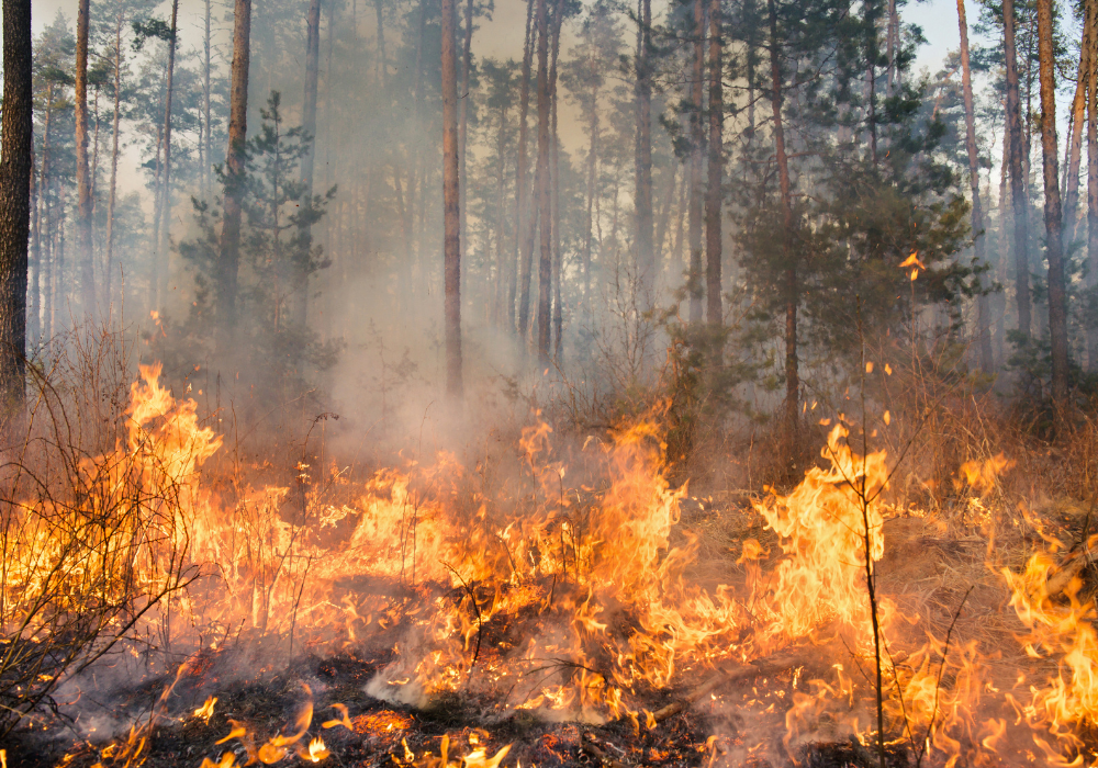
While we often associate storm tracks with rain and snow, they also influence wind patterns. A merged storm system can generate strong pressure gradients that result in fierce winds—perfect conditions for wildfires to spread rapidly. In places like California and the Southwest, hot dry winds (like the Santa Anas) could become stronger or occur during unexpected months.
If rain falls early in the year and stimulates vegetation growth, and hot winds arrive later without sufficient rain, it’s a recipe for explosive fire seasons. Weather volatility increases fuel availability and ignites more dangerous burn conditions.
9. Jet stream instability could disrupt airline routes and safety.
Airlines rely on relatively stable jet streams to plan fuel-efficient routes. If storm tracks merge and destabilize these upper-air flows, it could lead to bumpier flights, longer delays, and unpredictable air turbulence. Pilots might have to divert routes to avoid rough conditions, burning more fuel and raising costs. Some regions may see more frequent cancellations due to severe storms grounded by extreme winds, lightning, or low visibility.
The aviation industry already deals with climate-related challenges—adding volatile jet stream behavior could increase costs and affect travelers’ experience more frequently, even during what used to be calm seasons.
10. Emergency management systems may be overwhelmed more often.

When weather becomes less predictable and more extreme, emergency services struggle to keep up. A merging storm track doesn’t just change where storms happen—it compresses timelines, creates overlapping disasters, and makes long-term planning harder. Imagine dealing with a snowstorm, then flooding, then a tornado—all in one week.
Local and federal response teams may be stretched thin, especially in rural or underfunded areas. Insurance claims could skyrocket, and rebuilding might take years rather than months. As climate patterns shift, the U.S. will need stronger, more adaptable emergency frameworks to respond to a new era of storm behavior.