
Meteorologists monitor rapid intensification as Erin threatens to bring dangerous winds and flooding to coastal areas.

Tropical Storm Erin is rapidly gaining strength over the warm Atlantic waters, and weather experts are closely watching its potential to become the first hurricane of the 2025 season. The storm’s unexpected intensification has caught forecasters’ attention as wind speeds continue climbing toward hurricane-force thresholds.
Currently packing sustained winds of 65 mph, Erin sits just 9 mph below the 74 mph threshold that would officially classify it as a Category 1 hurricane. The National Hurricane Center has begun issuing advisories as the storm tracks toward populated coastal regions. Here’s what residents and travelers need to know about this developing weather situation.
1. Erin’s wind speeds have increased by 25 mph in just 12 hours, signaling rapid intensification.
Meteorologists define rapid intensification as wind speed increases of 35 mph or more within 24 hours. While Erin hasn’t quite reached that technical threshold, its current strengthening rate has forecasters concerned. The storm’s sustained winds jumped from 40 mph to 65 mph since yesterday morning, with some wind gusts already reaching 80 mph.
This acceleration indicates the storm is feeding off exceptionally warm ocean temperatures and favorable atmospheric conditions. If the current trend continues, Erin could easily cross into hurricane territory by tonight.
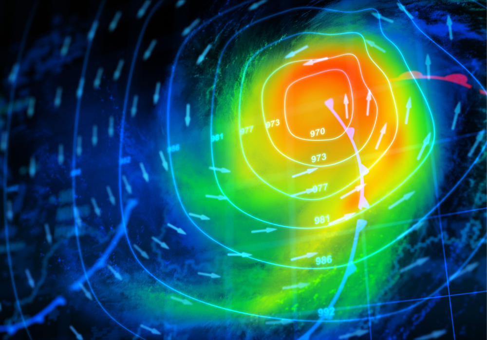
2. Ocean temperatures of 84°F are providing the perfect fuel for hurricane development.

The Atlantic waters beneath Erin are running 3-4 degrees warmer than normal for this time of year, creating ideal conditions for storm strengthening. Hurricanes draw their energy from warm ocean water, and temperatures above 80°F can sustain and intensify these systems significantly.
The unusually warm sea surface temperatures extend deep below the surface, meaning Erin won’t weaken as it moves through the area. These conditions, combined with low wind shear in the upper atmosphere, have created a highway for rapid storm development.
3. The National Hurricane Center has issued the first hurricane watch of the 2025 season for three states.
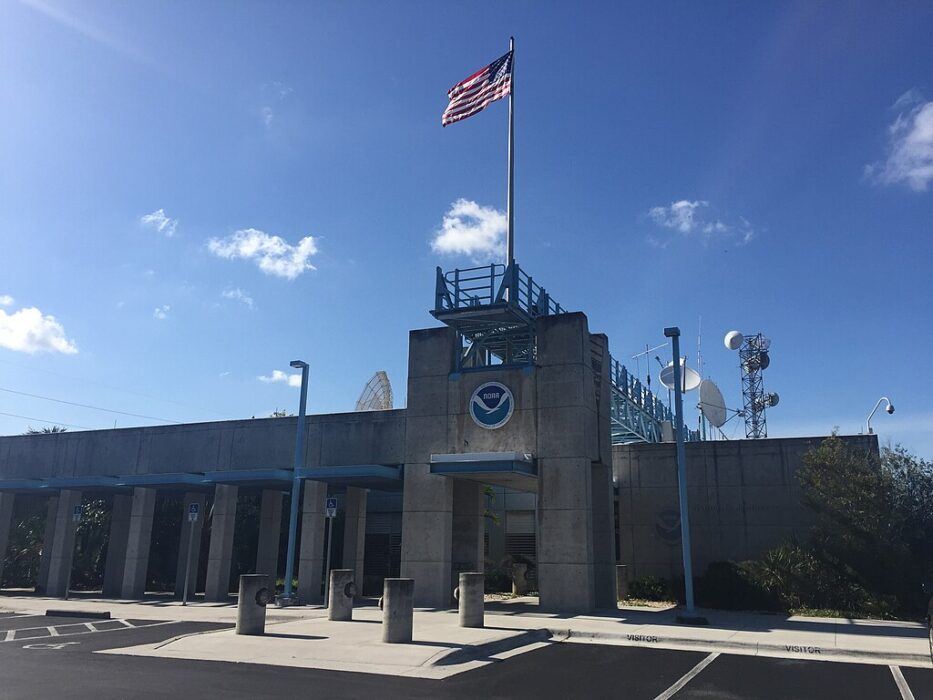
Hurricane watches are now in effect for portions of Florida, Georgia, and South Carolina as Erin’s projected path brings it dangerously close to the Southeast coast. A hurricane watch means hurricane conditions are possible within 48 hours, giving residents time to complete preparations.
This marks the earliest hurricane watch issued since 2020, when the Atlantic hurricane season started unusually active. Emergency management officials in all three states have activated their hurricane preparedness protocols and are coordinating with local authorities.
4. Current forecast models show Erin making landfall somewhere between Jacksonville and Charleston by Thursday.

The storm’s most likely track takes it toward the coast between northern Florida and southern South Carolina, though the exact landfall location remains uncertain. Forecast models are in relatively good agreement about the general path, but small shifts could mean the difference between a direct hit and a glancing blow for major population centers.
The hurricane center emphasizes that residents across the entire watch area should prepare for potential impacts. Even areas outside the direct path could experience dangerous conditions from the storm’s outer bands.
5. Storm surge predictions range from 3 to 7 feet above normal tide levels along the coast.
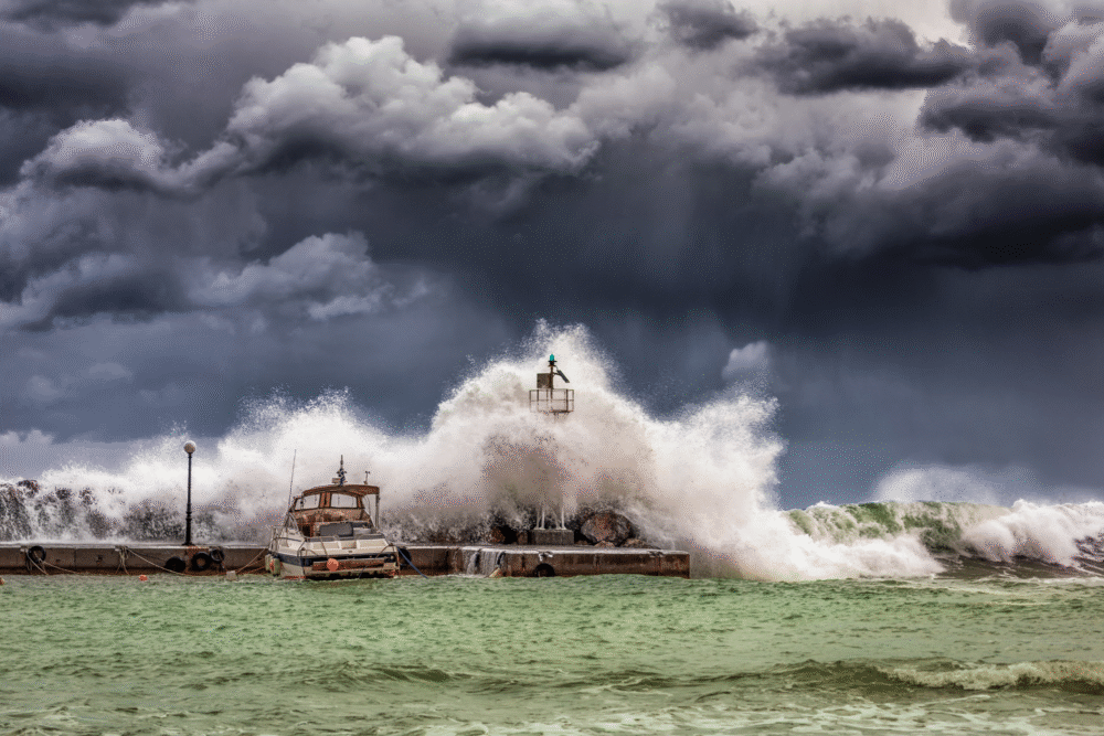
The most dangerous aspect of any hurricane is often the storm surge—the wall of ocean water pushed ashore by powerful winds. If Erin reaches hurricane strength, it could generate surge levels of 4-7 feet in the most vulnerable coastal areas, with 3-5 feet expected across a broader region.
Low-lying areas, barrier islands, and communities near inlets face the highest risk of life-threatening flooding. Even a Category 1 hurricane can produce deadly surge, especially during high tide periods when normal water levels are already elevated.
6. Rainfall totals could reach 8 inches across the Southeast, raising flash flood concerns.
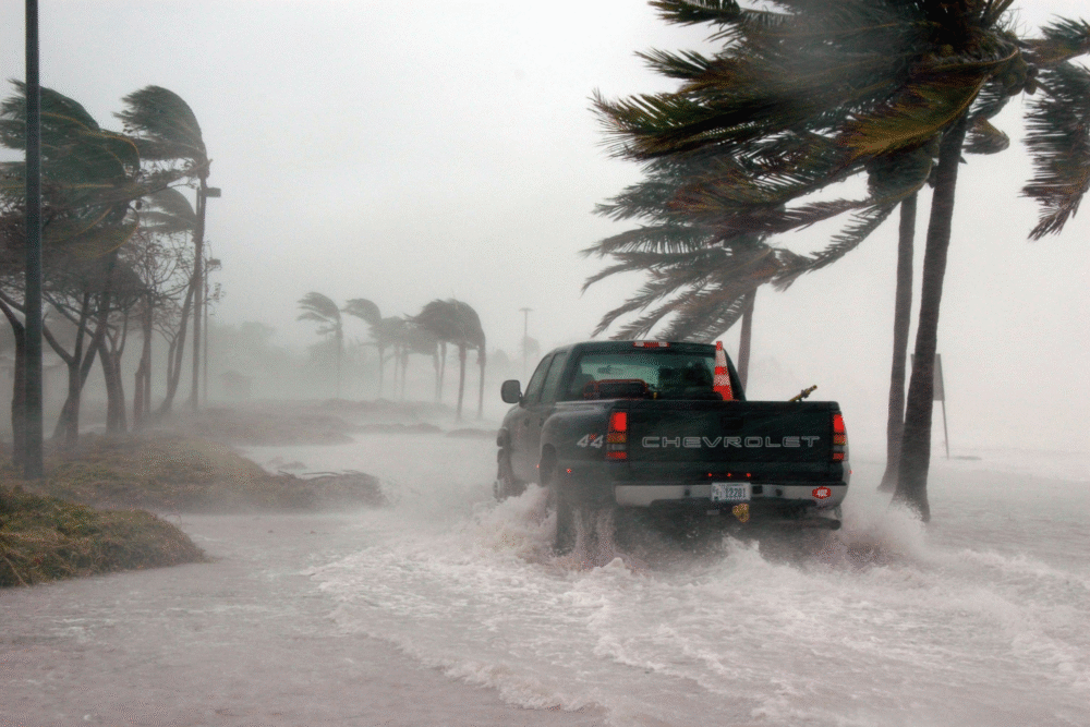
Beyond the coastal surge threat, Erin is expected to dump heavy rainfall across a large area as it moves inland. Forecast models predict 4-8 inches of rain across much of Georgia, South Carolina, and southern North Carolina, with isolated areas possibly receiving up to 10 inches.
This amount of rainfall in a short period can quickly overwhelm drainage systems and cause dangerous flash flooding in urban areas. Rivers and streams already running high from recent summer storms could overflow their banks, creating additional flood risks inland.
7. Airlines have begun issuing travel waivers for airports in the storm’s potential path.
Major airlines including Delta, American, and Southwest have started allowing passengers to change flights without penalty for travel to and from affected airports. The waivers currently cover airports in Jacksonville, Savannah, Charleston, and Myrtle Beach through Friday.
Travelers should expect significant flight delays and cancellations as the storm approaches, even at airports outside the direct impact zone. The Federal Aviation Administration is coordinating with airlines to minimize disruptions while prioritizing passenger safety during the weather event.
8. Emergency shelters are opening in coastal counties as evacuation orders could come within hours.

Local emergency management agencies are preparing shelter facilities and reviewing evacuation zone maps as Erin continues strengthening. Several coastal counties in Florida and Georgia have announced that evacuation orders for mobile homes, barrier islands, and flood-prone areas could be issued as early as this evening.
Residents in these vulnerable locations should not wait for official orders to begin making preparations or considering relocation to safer areas. Pet-friendly shelters and special needs facilities are also being readied for those requiring additional assistance.
9. Power companies are positioning crews and equipment for widespread outage restoration efforts.
Utility companies across the Southeast are moving repair crews and equipment into position ahead of Erin’s arrival. Duke Energy, Georgia Power, and Florida Power & Light have activated their storm response plans and are coordinating mutual aid agreements with other utilities.
Hurricane-force winds can bring down trees and power lines across large areas, potentially leaving hundreds of thousands without electricity. Restoration efforts typically can’t begin until winds drop below 35 mph, meaning outages could persist for several days in the hardest-hit areas.
10. This early hurricane formation continues the trend of increasingly active Atlantic seasons in recent years.

If Erin becomes a hurricane, it would mark the earliest first hurricane of the season since Hurricane Alex formed in January 2016. The Atlantic has produced above-normal hurricane activity in four of the past five years, with warmer ocean temperatures and changing atmospheric patterns contributing to more frequent early-season development.
Climate scientists note that while individual storms can’t be attributed directly to climate change, the overall pattern of stronger, more frequent hurricanes aligns with long-term climate projections. The 2025 season is forecast to be above normal, with 14-21 named storms predicted.Retry