
Hidden fault lines and unstable soil put millions at risk in cities you’d never expect.

When most Americans think about earthquakes, California instantly comes to mind. But while everyone’s watching the San Andreas Fault, nearly 75% of the United States could experience a damaging earthquake. From sleepy Southern towns to bustling Midwest metropolises, millions of people are living above geological time bombs they don’t even know exist.
The East Coast’s recent 4.8 magnitude quake near New Jersey was just a wake-up call—seismic threats are hiding in plain sight across America. These unexpected earthquake zones could catch entire regions completely unprepared.
1. America’s most dangerous hidden fault zone runs directly beneath Memphis
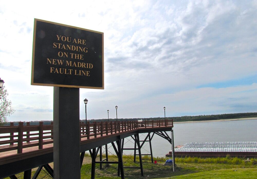
The New Madrid Seismic Zone, located in southeastern Missouri, northeastern Arkansas, western Tennessee, western Kentucky and southern Illinois, is the most active seismic area in the United States, east of the Rocky Mountains. Memphis, with over 650,000 residents, sits right in the crosshairs of this geological powder keg.
In the winter of 1811 and 1812, the New Madrid seismic zone generated a sequence of earthquakes that lasted for several months and included three very large earthquakes estimated to be between magnitude 7 and 8. Today’s Memphis wasn’t built to withstand such forces, and scientists don’t know why — or when — the next big one will strike.
2. A devastating 1886 earthquake could strike Charleston again without warning
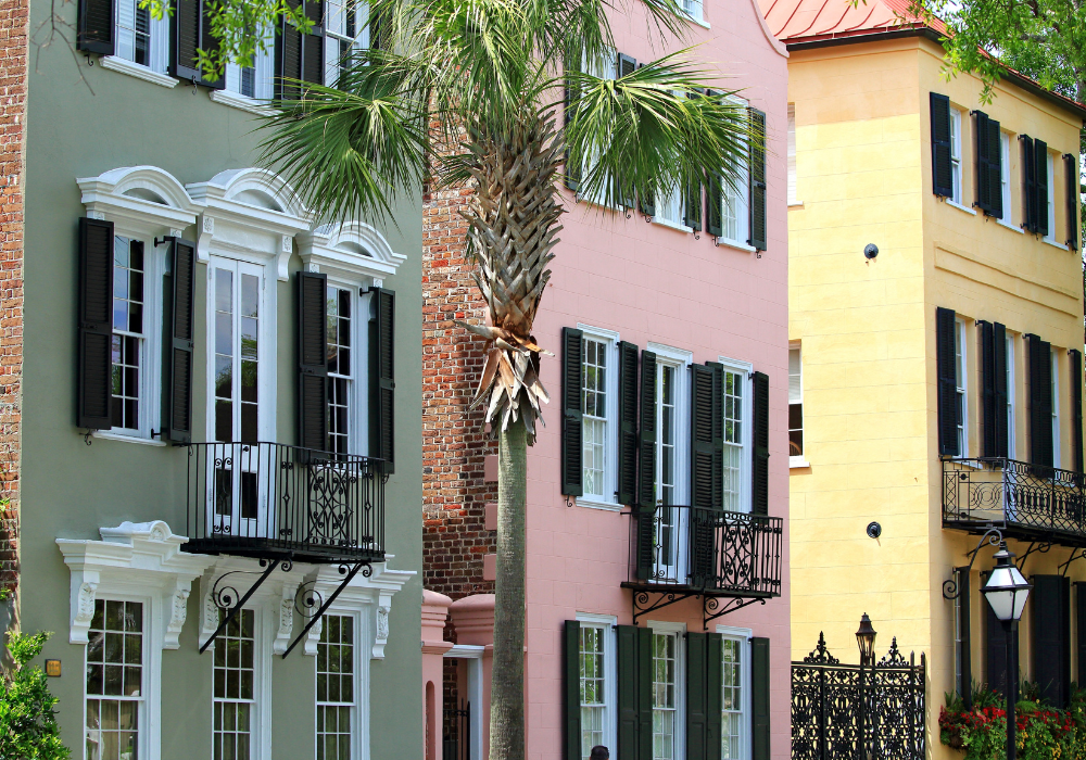
Charleston seems like the last place you’d worry about earthquakes, but this genteel Southern city experienced one of America’s most devastating quakes in 1886. The magnitude 7.3 earthquake killed 60 people and damaged nearly every building in the city, proving the East Coast isn’t as geologically stable as people assume.
What makes Charleston particularly vulnerable is that scientists still don’t fully understand the fault system that caused the 1886 disaster. The lack of visible surface faulting means another major earthquake could strike with little warning, catching the modern city completely off guard.
3. Colonial buildings throughout Boston weren’t designed for seismic shaking

In November of 1755, an earthquake with an estimated magnitude of 6.0 and a maximum intensity of VIII occurred about 50 miles northeast of Boston, Massachusetts. Boston was heavily damaged. Yet most Bostonians today have no idea their city sits in a seismically active region with multiple fault systems.
The city’s historic architecture, from colonial-era buildings to 19th-century brownstones, wasn’t constructed with earthquake resistance in mind. A moderate earthquake today could cause catastrophic damage to Boston’s irreplaceable historical structures and densely packed neighborhoods.
4. Active fault lines run directly beneath New York City’s towering skyscrapers

The Big Apple might seem rock-solid, but a rare 4.8 magnitude earthquake struck near Whitehouse Station New Jersey around 10:30 am EST, 50 Miles west of Manhattan in April 2024, reminding everyone that the region isn’t immune to seismic activity. The Ramapo Fault system runs right through the metropolitan area.
Manhattan’s towering skyscrapers and aging infrastructure weren’t designed for significant earthquake forces. While newer buildings meet modern seismic codes, much of the city’s housing stock and critical infrastructure dates back decades or even centuries, creating potential for widespread damage.
5. Critical bridges spanning America’s most active fault zone threaten St. Louis

St. Louis sits directly in the New Madrid Seismic Zone, making it one of the most earthquake-vulnerable major cities in America. Every year hundreds of small earthquakes occur in the NMSZ, however, most are too small to be felt by humans and can only be detected by sensitive instruments.
The city’s numerous bridges across the Mississippi River represent critical infrastructure that could fail during a major earthquake, cutting off transportation and commerce across the central United States. The economic implications of bridge failures would ripple across the entire country.
6. Earthquake country surrounds Little Rock in Arkansas’s hidden seismic zone
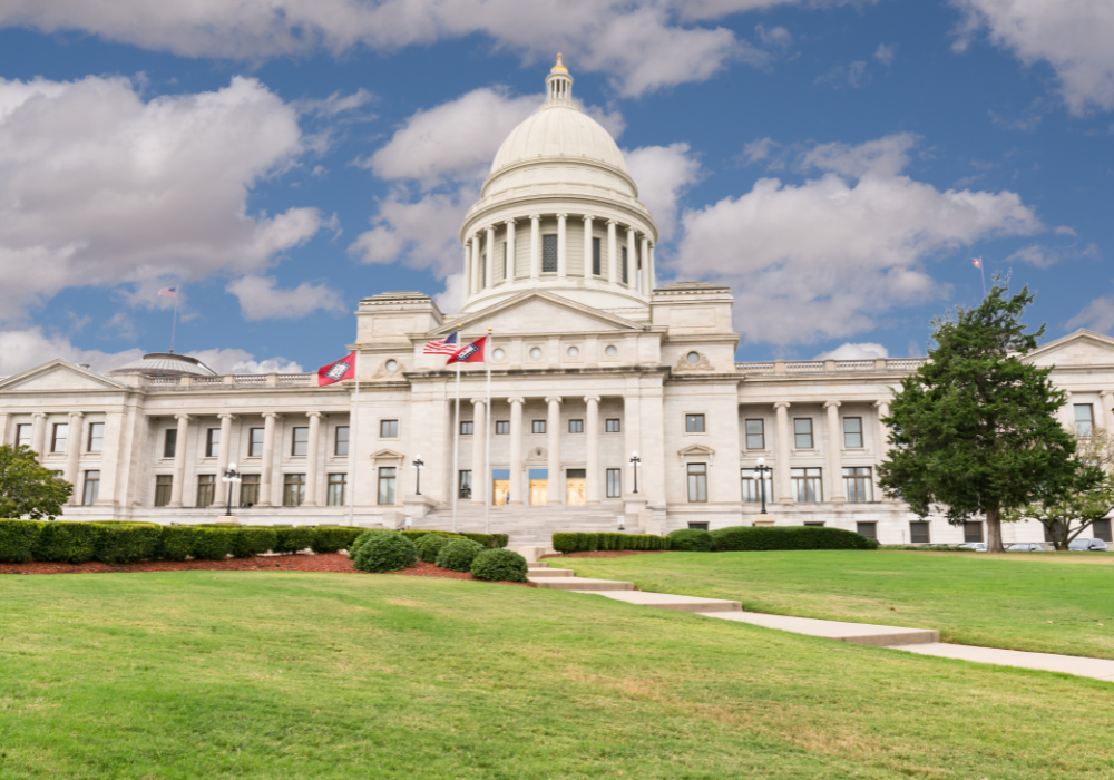
Arkansas might not scream “earthquake danger,” but Little Rock is situated right in the New Madrid Seismic Zone. The first in a series of major earthquakes occurred on December 16, 1811, at about 2:15 a.m. near present-day Blytheville, Arkansas. Estimated at magnitude (M) 7.7, this event awakened people across much of what is now the eastern United States.
The state capital’s location puts it at risk for the same type of devastating earthquakes that reshaped the landscape over 200 years ago. Modern Little Rock has grown significantly since then, with infrastructure and buildings that weren’t designed to handle major seismic events.
7. Soft river sediments could amplify earthquake damage throughout Louisville
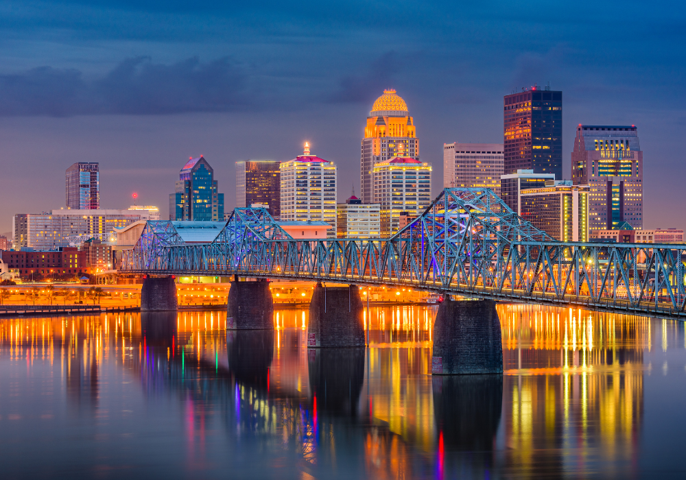
Louisville sits in a geologically complex area where the stable North American craton meets more active fault systems. The city’s position along the Ohio River means that earthquake waves could be amplified by the soft river sediments, potentially causing more damage than the actual earthquake magnitude would suggest.
The city’s bourbon distilleries, historic neighborhoods, and river infrastructure all face potential vulnerability from seismic activity. Many of Louisville’s older buildings, including its famous Victorian-era homes, lack modern earthquake-resistant construction features.
8. Critical Midwest transportation corridors converge in earthquake-prone Evansville

The area includes major cities such as Memphis, Tennessee, St. Louis, Missouri, Little Rock, Arkansas and Evansville, Indiana within the New Madrid Seismic Zone. Evansville’s location along the Ohio River makes it a crucial transportation hub that could be severely impacted by earthquake damage.
The city’s river bridges and industrial facilities represent critical infrastructure for the region’s economy. A major earthquake could disrupt coal shipping, manufacturing, and agricultural transportation throughout the Ohio Valley, creating economic ripple effects far beyond the immediate damage zone.
9. Nuclear facilities add serious urgency to Paducah’s earthquake concerns

Paducah, Kentucky, sits within the New Madrid Seismic Zone and hosts a uranium enrichment facility, adding nuclear safety concerns to earthquake risks. The facility’s location in an active seismic zone requires constant monitoring and special safety protocols that most people don’t realize exist.
The combination of earthquake risk and nuclear facilities creates a unique vulnerability that extends beyond typical seismic concerns. While modern safety systems are designed to handle earthquakes, the potential consequences of any failure make Paducah’s seismic risk particularly significant.
10. Hidden geological hazards lurk beneath Richmond’s historic James River valley

Virginia’s capital city experienced a wake-up call in 2011 when a magnitude 5.8 earthquake occurred in Virginia on August 23, 2011, causing damage to historic buildings and monuments. The James River valley’s geology can amplify seismic waves, making earthquakes more destructive than their magnitude might suggest.
Richmond’s colonial and Civil War-era architecture, combined with modern government buildings, creates a complex vulnerability profile. The city’s role as Virginia’s capital means that earthquake damage could disrupt state government operations and emergency response coordination across the entire Commonwealth.