
Scientific evidence uncovers rapid shifts from green landscapes to desert in the Sahara.
The Sahara Desert, known today for its vast arid expanse, was once a much greener and wetter region. Archaeological and geological records reveal that this transformation occurred abruptly, driven by natural climate cycles and hydrological changes. By studying fossilized plants, ancient lake beds, and sediment layers, scientists gain insight into how quickly and dramatically the Sahara’s environment can flip from lush to barren.
1. Fossilized plants show the area once supported lush greenery and water.
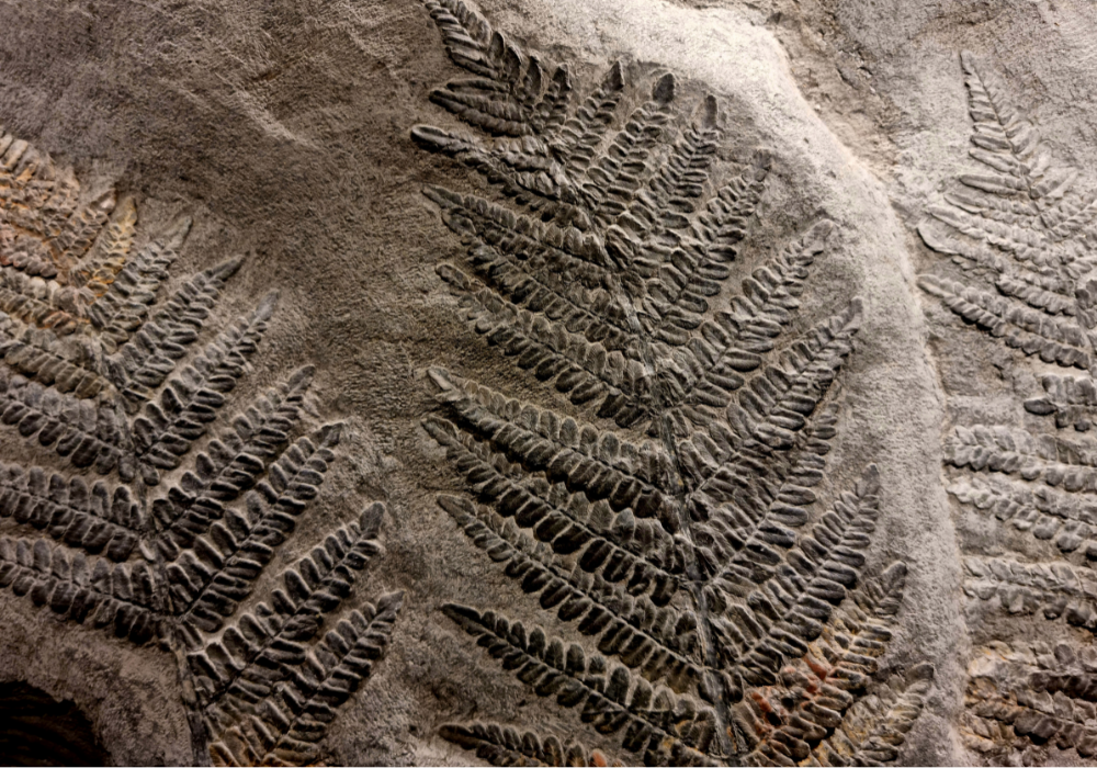
Fossilized plants and pollen grains offer intriguing insights into the Sahara’s past. Researchers have found remnants of ancient flora buried beneath the desert sands. These fossils indicate that the region once supported verdant landscapes, full of diverse plant species.
This lush greenery, sustained by water, provided the necessary resources for a thriving ecosystem. The presence of such fossilized plants highlights the dramatic climatic changes the Sahara experienced over millennia, transitioning from a fertile region to a vast desert, suggesting rapid environmental transformations.
2. Ancient lake beds reveal evidence of widespread freshwater bodies in the past.
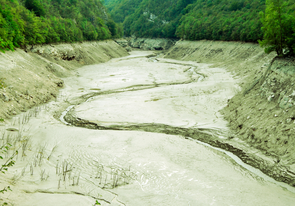
Ancient lake beds across the Sahara reveal a different picture of the past. Geological evidence shows that vast freshwater bodies once dotted the region, providing key resources for life. These lake beds, now dry, indicate that water was once abundant.
The evidence of these large water bodies helps scientists understand how climatic conditions could support life far different from what we see today. The Sahara’s shift from wetland to desert underscores the potential speed and intensity of environmental change due to climate shifts.
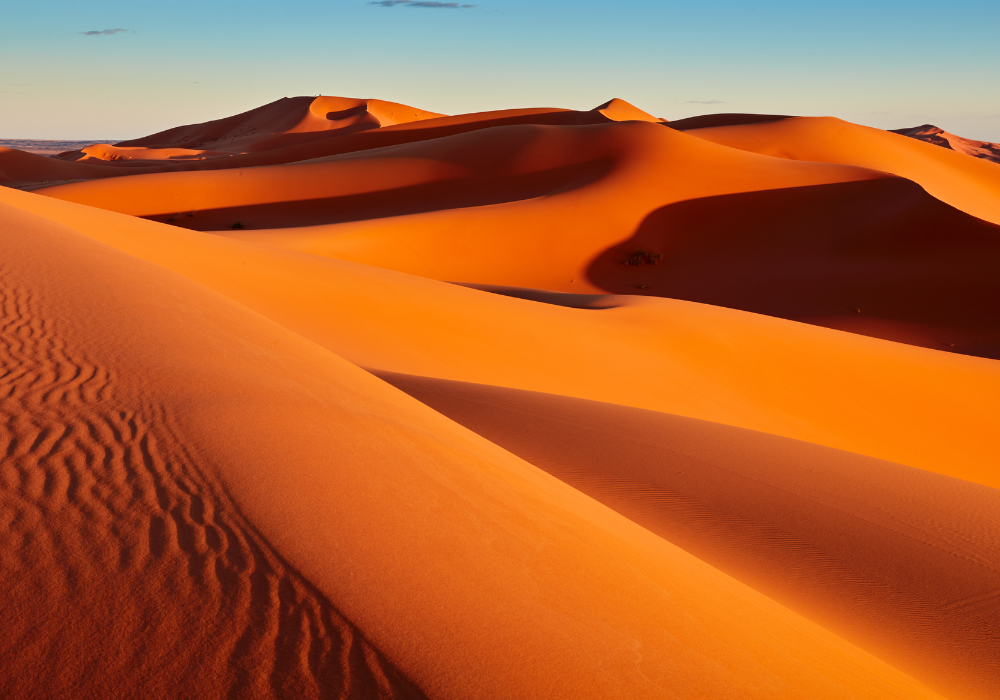
3. Sand dunes contain layers indicating cycles of wet and dry periods.
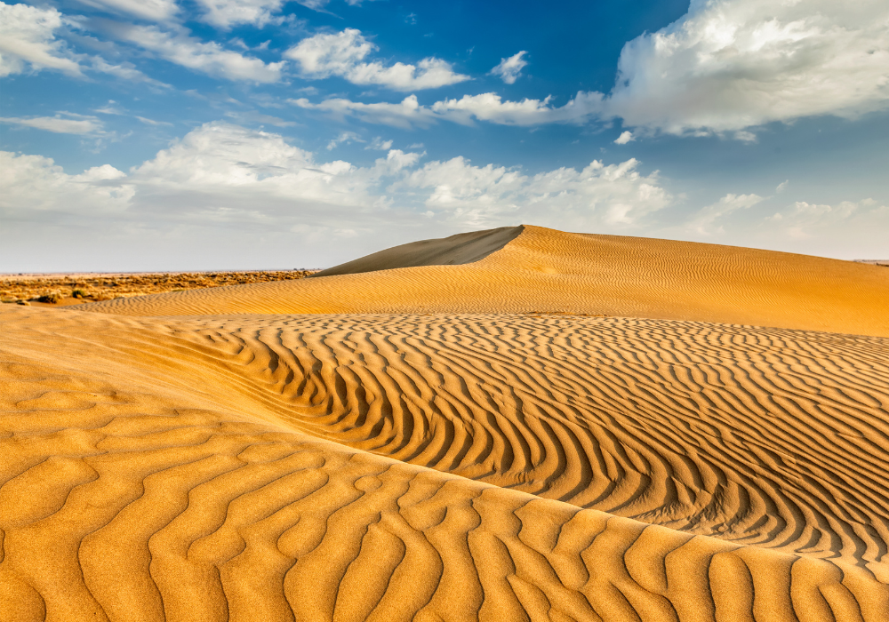
Sand dunes are not just piles of sand; they are historical records of environmental patterns. Layers within the dunes show cycles of wet and dry periods over time. These layers provide evidence of past climates and the Sahara’s changing conditions.
Understanding these cycles helps researchers predict how current and future climate conditions could affect the region. The sediment layers in dunes serve as timelines of when and how quickly transformations occurred, marking periods of significant climatic changes.
4. Remnants of prehistoric animal bones suggest a thriving ecosystem long ago.
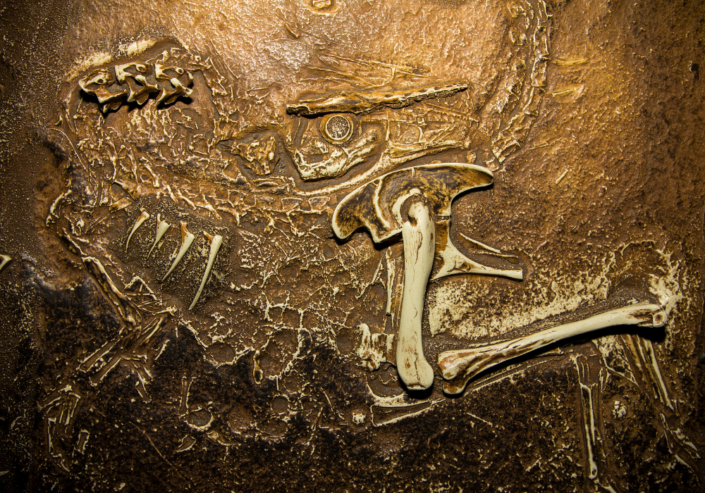
Within the Sahara, remnants of prehistoric animal bones tell stories of a once-flourishing ecosystem. These bones, discovered across the region, suggest that diverse animal species thrived when the environment could sustain them.
The presence of such bones challenges common perceptions of the Sahara as perpetually arid. It highlights periods when animals roamed alongside rivers and grasslands, evidence of abrupt yet significant ecosystem changes driven by shifts in climate.
5. Rock art depicts scenes of rivers and abundant wildlife in the region.
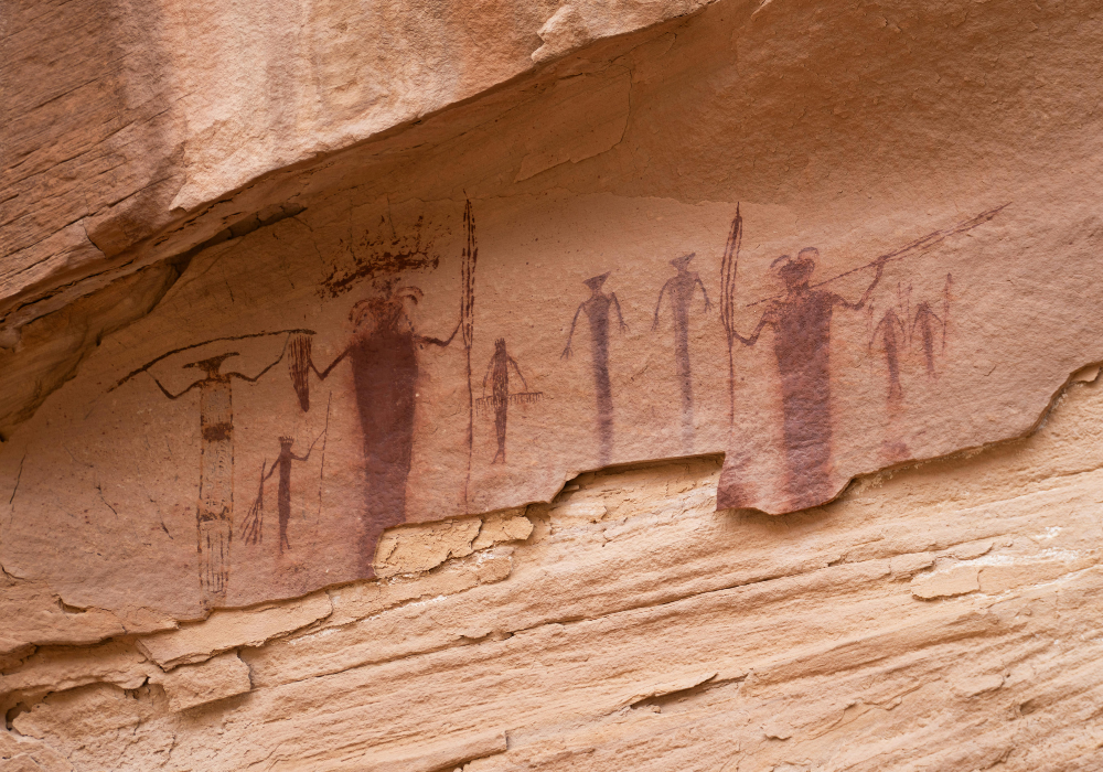
Ancient rock art in the Sahara provides vivid depictions of a past ecosystem teeming with life. These artworks capture scenes of rivers, wildlife, and human activity, indicating a much wetter and bountiful environment.
This art adds a cultural dimension to our understanding of the Sahara’s historical climate. Depictions of abundant wildlife and water sources show that those who lived there witnessed significant transformations, offering a unique perspective on the effect of climate on human history.
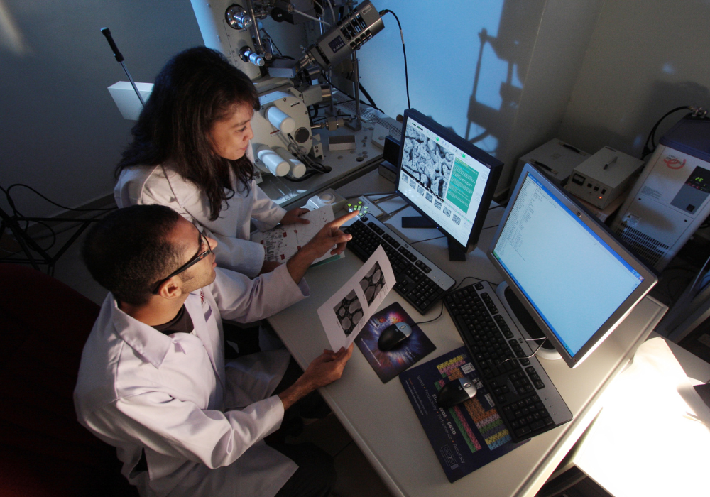
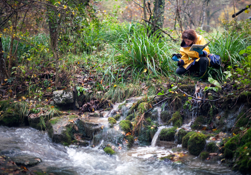
6. Isotopic analysis of soil uncovers fluctuations in past rainfall patterns.
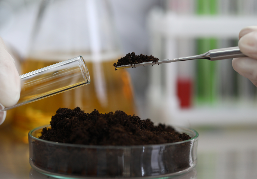
Isotopic analysis of soil samples provides a window into past rainfall patterns in the Sahara. This method helps scientists determine changes in precipitation over thousands of years by analyzing chemical signatures preserved in the earth.
Fluctuations in these isotopic markers reveal periods of increased rainfall, suggesting the region once experienced more humid conditions. By understanding these past patterns, scientists gain valuable insights into the potential for future climatic swings and environmental adaptation.
7. Pollen grains preserved in sediment help reconstruct historical vegetation changes.

Pollen grains preserved in sediment are key to reconstructing historical vegetation in the Sahara. These tiny particles, trapped over time, offer evidence of plant species that thrived when conditions allowed for lush landscapes.
The presence of diverse pollen types suggests significant shifts in vegetation as the climate changed. Analyzing this data helps scientists understand the interplay between climate and ecosystem resilience, and how such knowledge can apply to current environmental challenges.
8. Cave deposits contain mineral formations that indicate previous humid conditions.
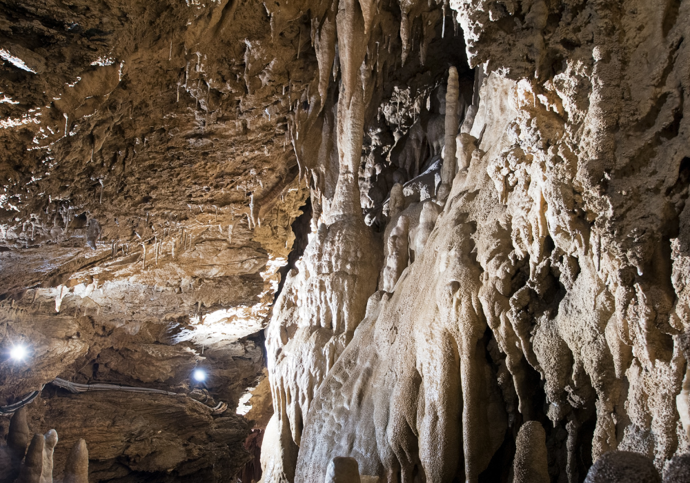
Cave deposits in the Sahara hold mineral formations that mark previous humid conditions. Stalagmites and stalactites formed from water dripping in caves can indicate historical climate by their chemical makeup, providing a record of past environmental conditions.
These mineral records reveal significant humidity shifts over time, supporting evidence of periods when the Sahara was far more conducive to life. Examining these formations helps deepen our understanding of natural climate cycles and their impact on regional transformations.
9. Satellite images reveal hidden river channels beneath desert sands today.

Modern technology, like satellite imagery, uncovers hidden structures beneath the Sahara’s sands. These images reveal ancient river channels, indicating where waterways once flowed through the current desert landscape.
Discovering these buried channels helps scientists piece together the region’s dynamic hydrological past. By mapping these structures, experts gain insights into how landscape formations change over time, contributing to broader studies on long-term environmental shifts.
10. Archaeological finds include tools used by humans in once-fertile lands.
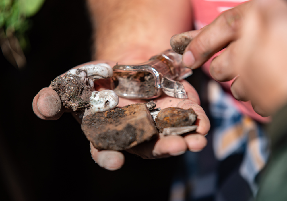
Archaeological finds of tools in the Sahara suggest human habitation in once-fertile lands. These implements, discovered amid desert sands, reveal that people adapted to and thrived in the region’s ancient ecosystems.
Such discoveries highlight the significant changes the area underwent. The tools underscore the adaptability of early humans to environmental shifts, offering a glimpse into how climate shaped human history and migration routes.
11. Climate models use data from sediment layers to track rapid environment shifts.
Climate models incorporate data from sediment layers to understand the Sahara’s rapid environmental shifts. These layers contain crucial information about past conditions and change rates, helping to simulate the region’s climate history.
By utilizing this data, scientists can predict how quickly environmental changes might happen again. These models provide critical insights into the potential impacts of current climate changes on landscapes and support discussions about future ecological resilience.
12. Ancient groundwater records show sudden drops corresponding to desertification events.
Ancient groundwater records tell a detailed story of sudden drops that correspond with desertification events. These records help trace the historical shifts in water availability that transformed the Sahara from lush landscapes to an arid desert.
Examining these changes offers a clear picture of how desertification transpired, underlining the natural cycles that drive such transformations. Understanding these patterns is essential for facing contemporary environmental challenges and anticipating future landscape changes.