
From jungle lasers to AI maps, new tools are exposing lost cities and buried landscapes.
For a long time, archaeology moved at walking speed. If a forest was too thick, a swamp too wet, or a desert too wide, whole chapters of history stayed hidden in plain sight.
Now planes, drones, and satellites can “see” what the eye can’t. Lasers map the ground beneath tree cover, radar highlights buried features under sand, and AI helps researchers spot shapes that look like noise to most people.
The result is a wave of surprises: lost cities, hidden roads, and forgotten earthworks reappearing on modern maps. And once a map points the way, teams can dig, date, and confirm what’s real, with less guesswork.
1. The big shift is “remote seeing,” not guesswork
Archaeologists used to start with old texts, local stories, and a lot of hiking. That still matters, but new tools can scan huge areas fast and reveal shapes humans would never notice from the ground.
Think of it like turning the Earth into a readable map. Lasers, radar, and high-resolution imagery highlight lines, mounds, canals, and foundations. Then researchers use those clues to choose where to walk, where to dig, and where to protect a site before it’s disturbed.
2. Jungle-penetrating LiDAR rewrote the Maya landscape
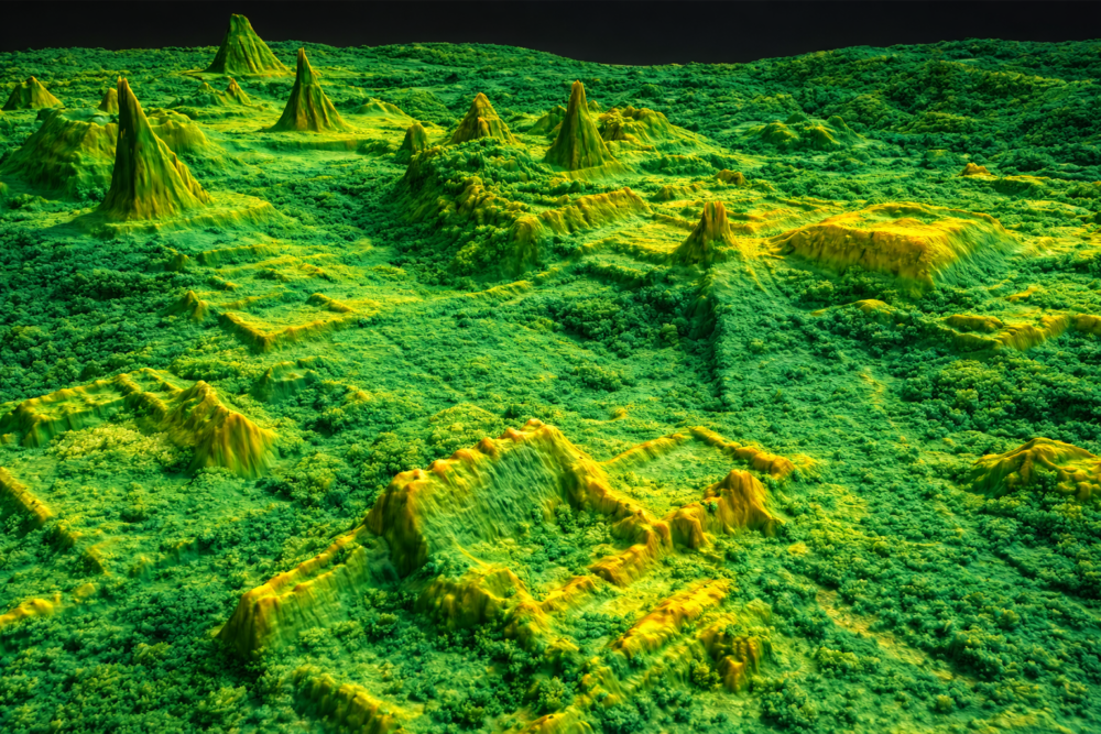
In northern Guatemala, airborne LiDAR stripped away the forest canopy in the data, revealing tens of thousands of Maya structures—homes, terraces, walls, and long raised roads called causeways.
What surprised researchers wasn’t just “more ruins.” It was how connected everything looked, like a web of cities and farmland engineered at a massive scale. LiDAR didn’t replace excavation, but it gave archaeologists a new blueprint, showing where people likely lived, farmed, fought, and traveled.
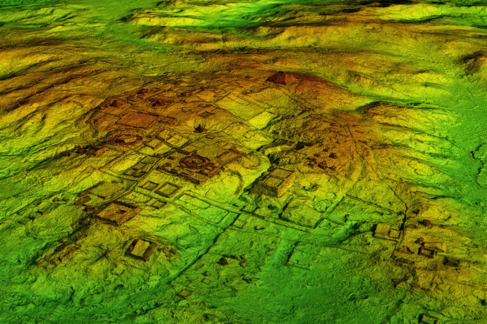
3. In Cambodia, lasers revealed cities hiding around Angkor
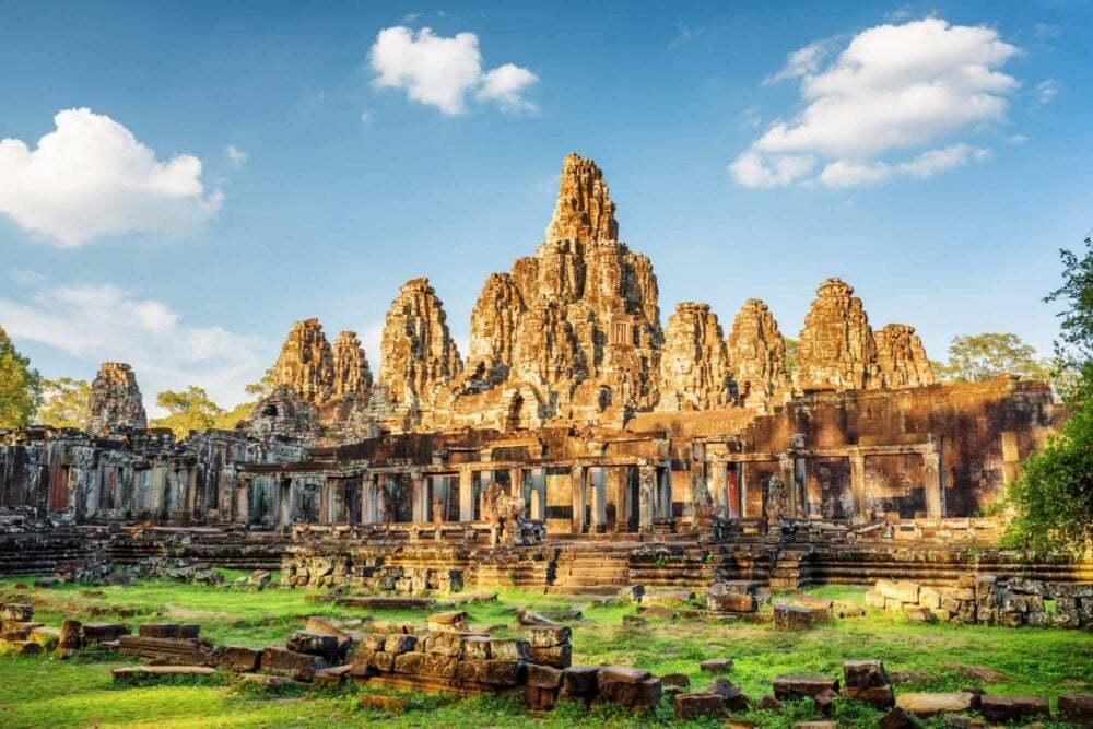
Angkor was always famous for its temples. LiDAR helped show the temples were only the showpiece of a larger urban world, with grids, ponds, mounds, and waterworks spread through the forest.
One headline find was the scale of Mahendraparvata, an early Khmer center near Phnom Kulen. By mapping the ground in detail, researchers traced roads and neighborhoods that were nearly impossible to see on foot. Suddenly, Angkor looked less like a single monument and more like a whole region.
4. The Amazon is giving up “lost city” patterns from the air
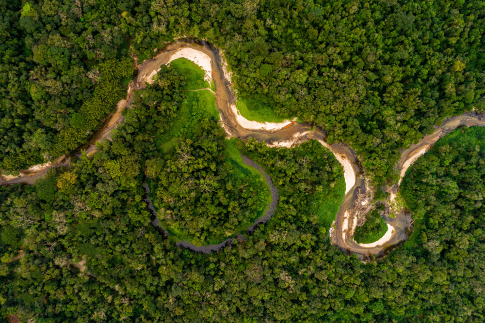
Dense rainforest once made big settlements hard to imagine, because roads and walls vanish under trees. Airborne mapping has challenged that, revealing earthworks, raised fields, and organized layouts hidden under canopy.
In places like Bolivia’s Llanos de Mojos, LiDAR has outlined large centers linked by causeways and canals. The shapes suggest planned communities with water management, not small scattered camps. Each new map pushes questions: who built it, how many lived there, and how it worked.
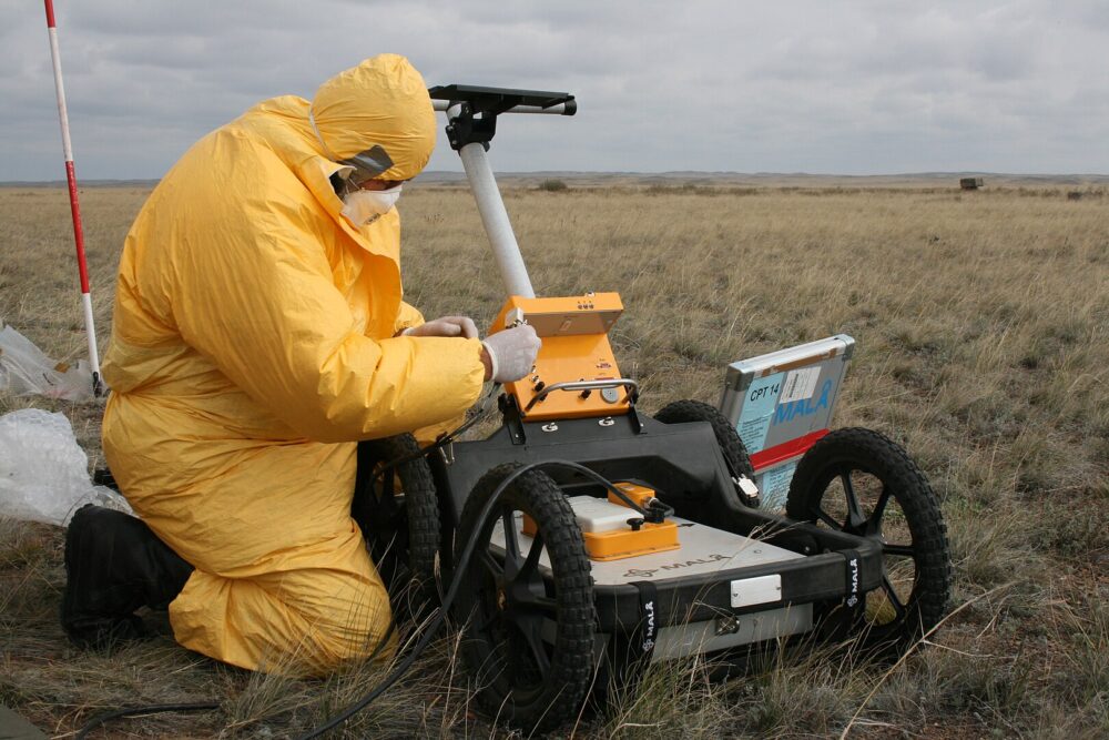
5. Ground-penetrating radar found surprises near Stonehenge
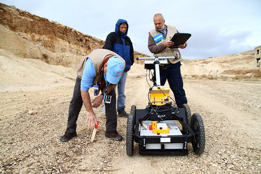
Not every discovery happens in a jungle. Around Stonehenge, large geophysical surveys used ground-penetrating radar and magnetometry to map what lies below the grass without digging it up first.
The result was a hidden landscape of pits, ditches, and structures that hint at ceremonies and movement across the plain. It helped researchers see Stonehenge as one piece of a much bigger complex. And because the method is non-invasive, teams can explore sensitive areas while keeping the ground largely intact.
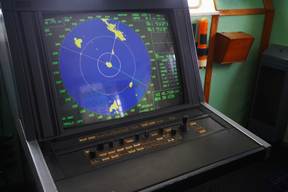
6. Satellite radar can spot features buried under desert sands

In some deserts, optical photos show only dunes. Radar, however, can highlight roughness and buried channels, sometimes revealing old riverbeds, tracks, or settlement patterns that sand has covered.
NASA’s Shuttle Imaging Radar missions famously showed how radar can bring out hidden features that don’t pop in regular images. For archaeologists, that means a better chance of finding ancient routes and water sources—exactly the kinds of places people once built towns. It’s like seeing the “ghost map” beneath the sand.
7. AI is speeding up the hunt for hard-to-spot geoglyphs
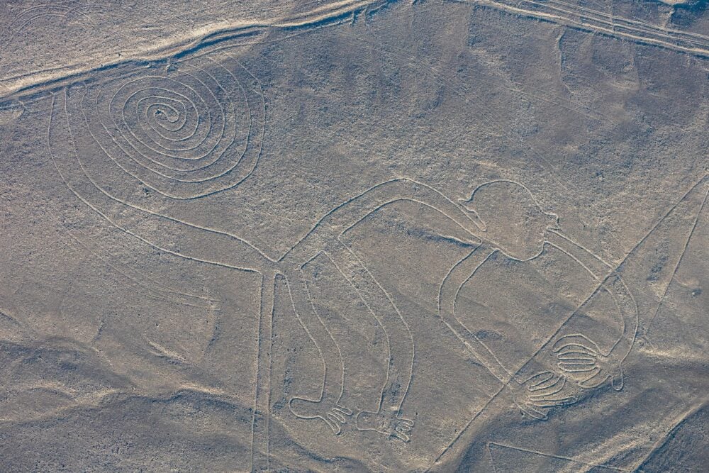
Human eyes get tired. AI doesn’t, and that’s part of the appeal. In Peru’s Nazca region, researchers used AI to flag likely geoglyph candidates across huge image datasets.
Field teams then checked the strongest leads on the ground and confirmed hundreds of previously unknown figures. The exciting part isn’t just the number. It’s the workflow: computers narrow the search, then archaeologists verify. That partnership can turn years of scanning into months without skipping the careful confirmation step.
8. Cosmic-ray “X-rays” can reveal voids inside stone monuments
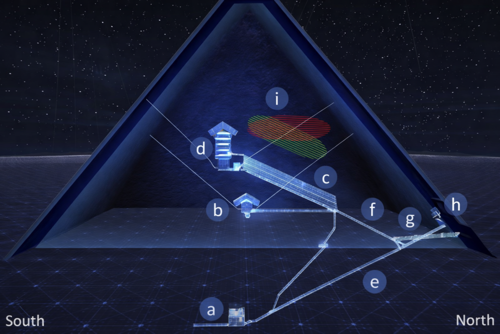
Some ancient structures can’t be opened without damage. Muon tomography offers a workaround by tracking cosmic-ray particles that pass through stone. Dense areas block more particles; empty spaces block fewer.
That method helped researchers detect a large hidden void inside Egypt’s Great Pyramid, a major internal feature revealed in modern times. It didn’t “solve” the pyramid, but it opened new questions about construction and unknown spaces. It’s archaeology that feels like medical imaging—noninvasive, but powerful.
9. Sonar and 3D mapping are rebuilding underwater towns
Some “hidden structures” are hidden by water, not soil. Off Greece, the submerged Bronze Age town of Pavlopetri has been mapped with sonar, photogrammetry, and detailed digital surveying.
Instead of guessing where streets ran, researchers can build precise 3D plans of buildings, courtyards, and lanes. That makes underwater archaeology feel less like treasure hunting and more like city planning in reverse. It also supports protection, because you can document what’s there before storms or anchors damage it.
10. Photogrammetry is turning fragile ruins into shareable 3D models
Not every breakthrough is about finding a new city. Sometimes it’s about recording what we already know before erosion, crowds, or weather wear it down. Photogrammetry stitches overlapping photos into accurate 3D models.
Teams use it in caves, tombs, temples, and on small artifacts. The payoff is practical: measurements are easier, damage is easier to spot, and researchers can study a site without traveling. It also lets the public “visit” places that are too fragile for heavy tourism.
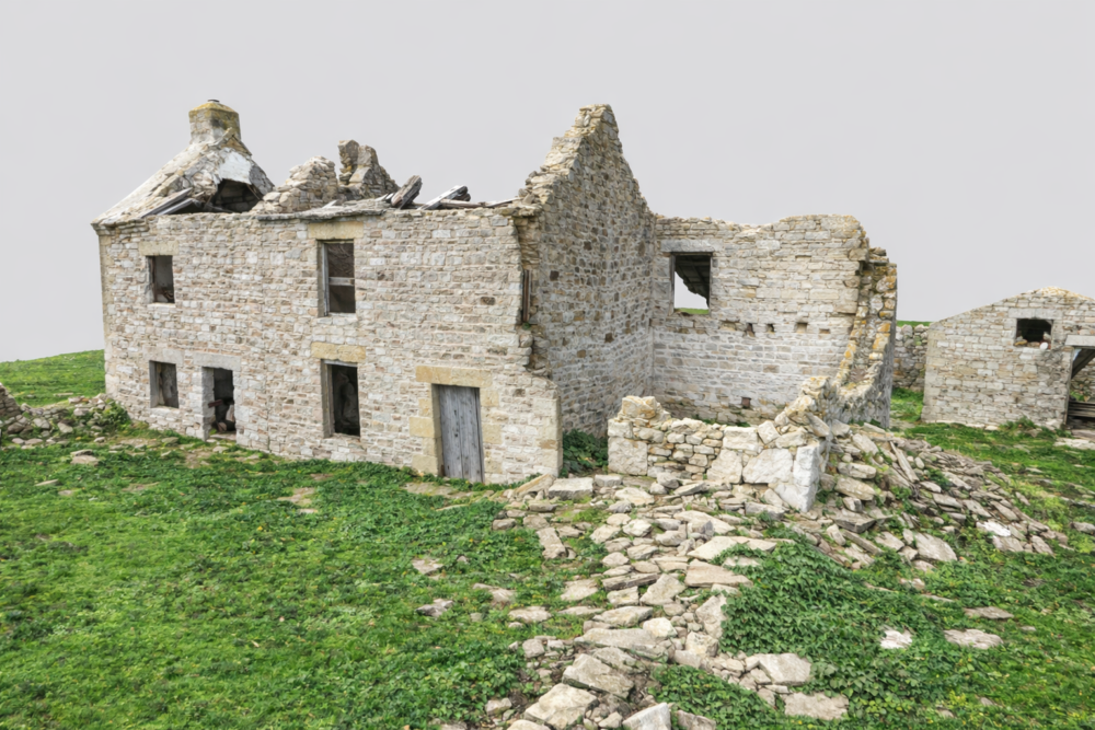
11. New tech can mislead, so field checks still matter
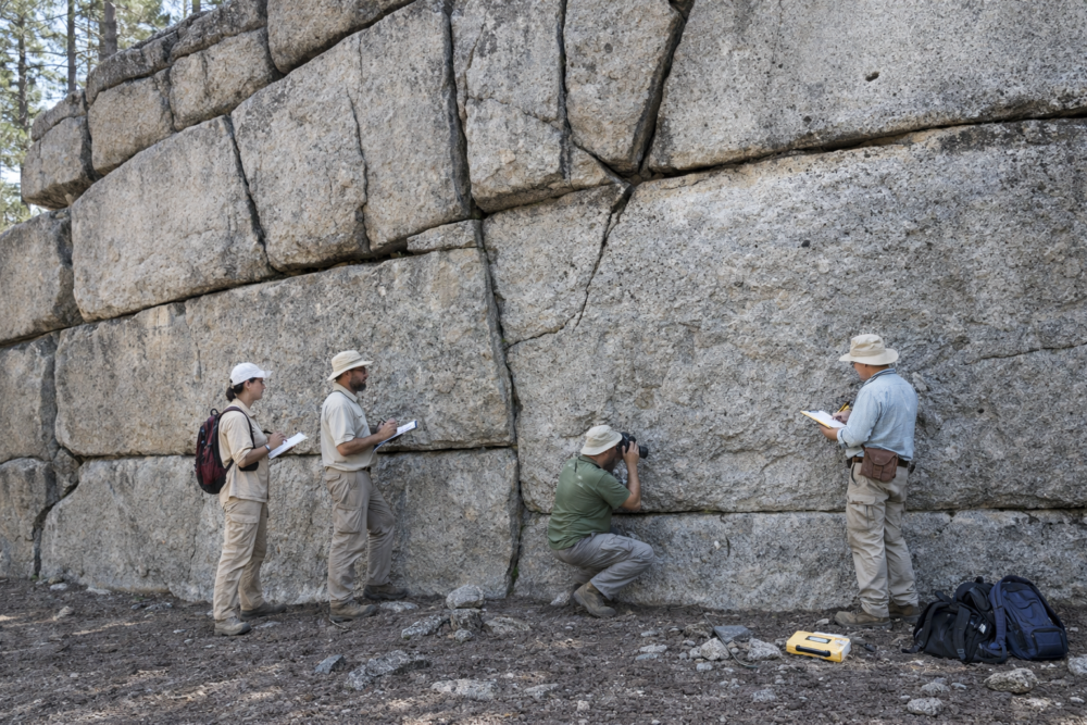
These tools are amazing, but they can fool you. A straight line on a scan might be a wall—or it might be a natural ridge, a modern ditch, or a processing artifact.
That’s why archaeologists insist on ground truthing: walking the spot, sampling soil, checking artifacts, and confirming dates. It’s slower, but it keeps the story honest. The best projects treat remote sensing as a guide, not a verdict. Technology points to possibilities; careful fieldwork decides what’s real history.
12. The next era may be global discovery with smarter limits
The biggest change is speed. Researchers can scan huge regions, spot patterns, and build maps that would have taken lifetimes a generation ago. That’s thrilling—and it comes with responsibility.
Some discoveries need protection, not publicity, because looting and damage can follow attention. Expect more projects that pair mapping with ethics: working with local communities, limiting exact coordinates, and focusing on preservation. The goal isn’t just to find the past—it’s to keep it safe once it reappears.