
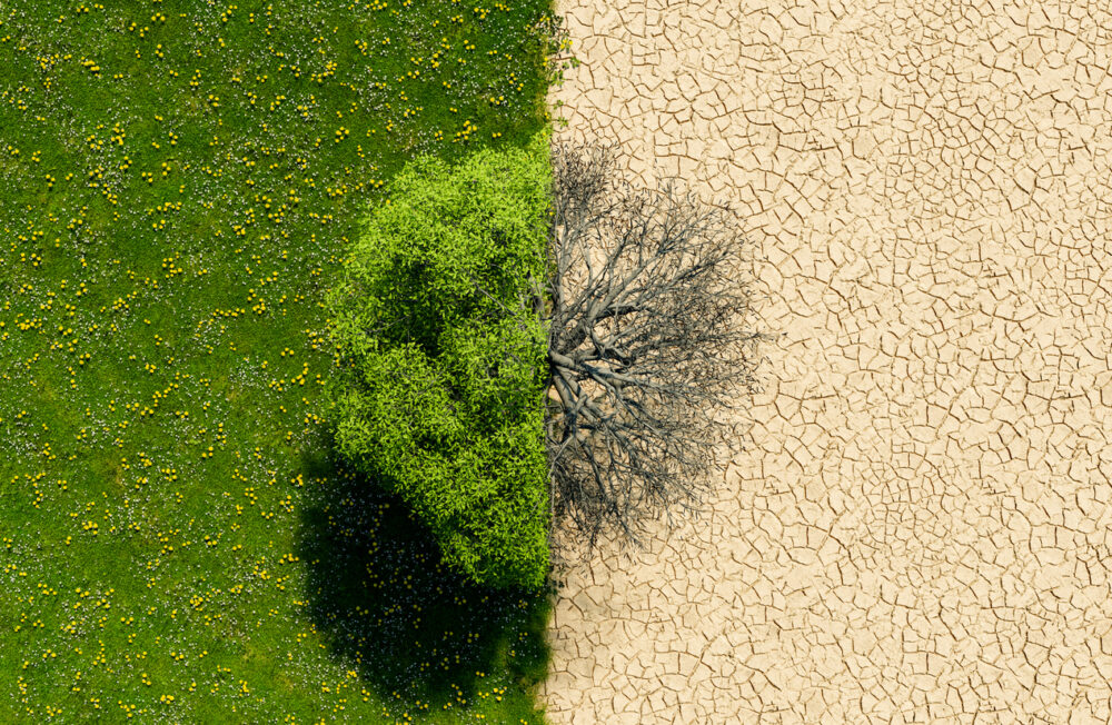
Advanced satellite data reveals accelerating deforestation, climate-driven forest die-offs, and ecosystem collapse across Amazon and boreal regions worldwide.
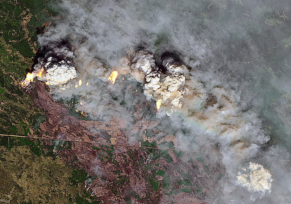
Satellites orbiting 400 miles above Earth are capturing a devastating transformation happening to our planet’s forests. The images are stark and undeniable: 2024 marked the worst year for forest destruction in recorded history, with fires alone consuming an area nearly the size of Panama in tropical rainforests. For the first time since satellite monitoring began, wildfires—not agriculture—became the leading cause of forest loss in regions that aren’t supposed to burn.
From the Amazon’s unprecedented drought-fueled blazes to Canada’s record-breaking boreal forest fires, advanced satellite technology is revealing how climate change is rewriting the rules of forest survival across every continent.
1. Satellites captured the moment tropical rainforests started burning like never before.
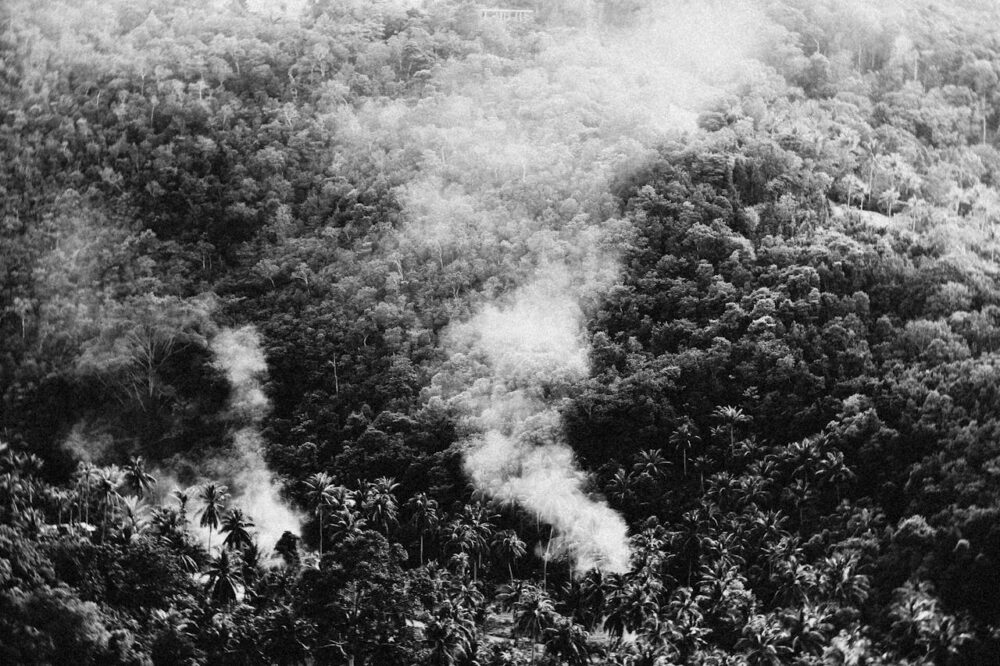
2024 became the first year that major fires raged across both tropical and boreal forests simultaneously since satellite monitoring began. The tropics lost a record-shattering 6.7 million hectares of primary rainforest, nearly twice as much as 2023. Advanced satellite systems from NASA and the European Space Agency documented fires consuming 18 soccer fields of pristine rainforest every minute, according to Earth.com.
These aren’t the occasional natural fires forests can recover from—these are climate-driven infernos destroying ecosystems that took centuries to develop and store massive amounts of carbon.
2. The Amazon rainforest is literally transforming before our eyes in satellite imagery.
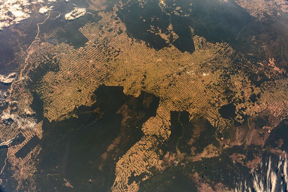
Satellite data reveals that Brazil’s Amazon experienced its highest tree cover loss since 2016, jumping 110% from 2023 to 2024, with 60% caused by fires during the worst drought ever recorded. The images show a devastating pattern: what once appeared as dense green canopy in satellite photos now shows brown scars spreading across the landscape, Yahoo! News reports.
Scientists monitoring the changes say we’re witnessing the Amazon approach a potential tipping point where this self-sustaining rainforest system could permanently shift into dry savanna, fundamentally altering global climate patterns forever.
3. Canada’s boreal forests are releasing more carbon than all global air travel combined.
Satellite monitoring systems tracked Canada’s 2023 wildfires as they burned 7.8 million hectares—six times the country’s annual average—releasing nearly 3 billion tons of carbon dioxide into the atmosphere. The images reveal fires so massive their smoke traveled to Europe and China, while the heat signatures showed temperatures up to 18 degrees Fahrenheit above normal, as mentioned by Vox.com.
These boreal forests store 30-40% of all land-based carbon globally, and satellite data confirms they’re now releasing more carbon than they absorb, accelerating climate change in a dangerous feedback loop.
4. Advanced AI analyzing satellite images discovered alarming patterns scientists missed.
The latest satellite technology uses deep learning algorithms to analyze millions of images and identify forest destruction patterns invisible to human observers. This AI system, developed by World Resources Institute and Google DeepMind, can distinguish between different causes of forest loss at unprecedented resolution—detecting everything from small wildfires to illegal logging operations.
The technology revealed that 531 of the exercise-regulated genes are identified as being in the secretome, meaning forest loss drivers are more complex and interconnected than previously understood, requiring completely new conservation strategies.
5. Satellite data shows fires are now destroying forests faster than they can regrow.
Real-time satellite monitoring reveals that 2024’s forest fires released 4.1 gigatons of greenhouse gases—more than four times the emissions from all air travel in 2023. The images capture a terrifying reality: forests that historically recovered from occasional fires are now burning so frequently and intensely that they can’t regenerate.
Satellite analysis shows fire-related tree cover loss in boreal regions increased by 160,100 hectares per year over the past 24 years, fundamentally changing these ecosystems’ ability to serve as carbon sinks and climate stabilizers.
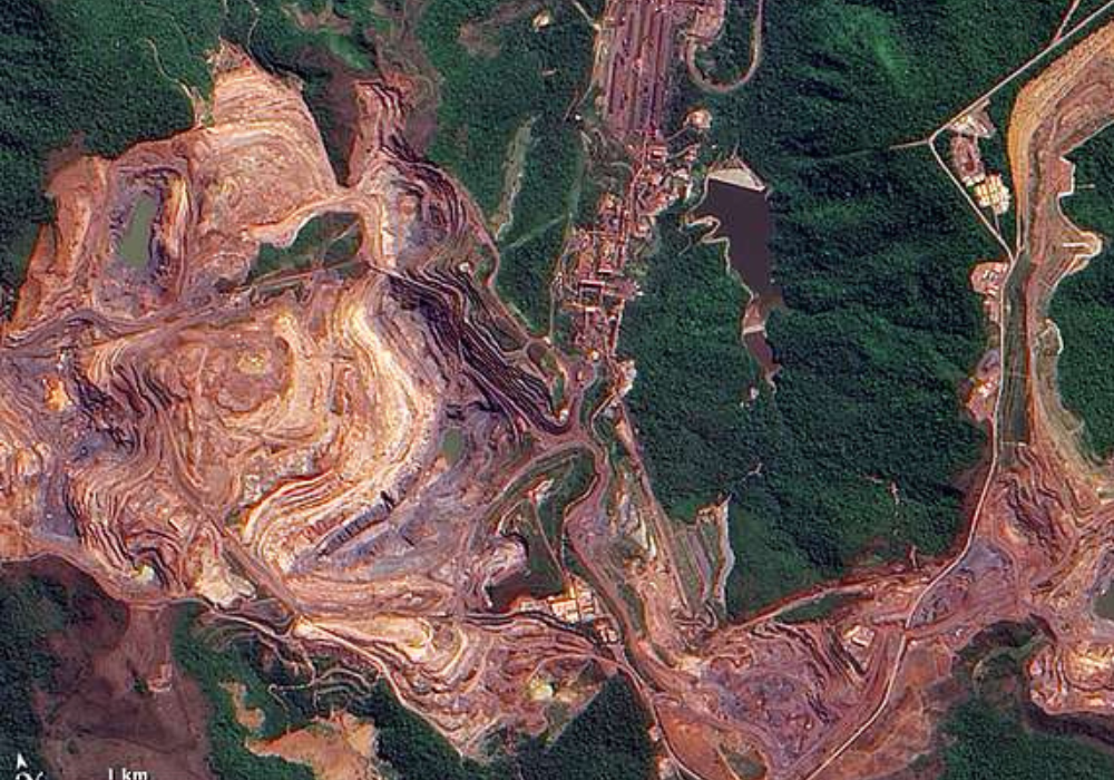
6. Hidden deforestation patterns emerge when satellites combine multiple imaging technologies.
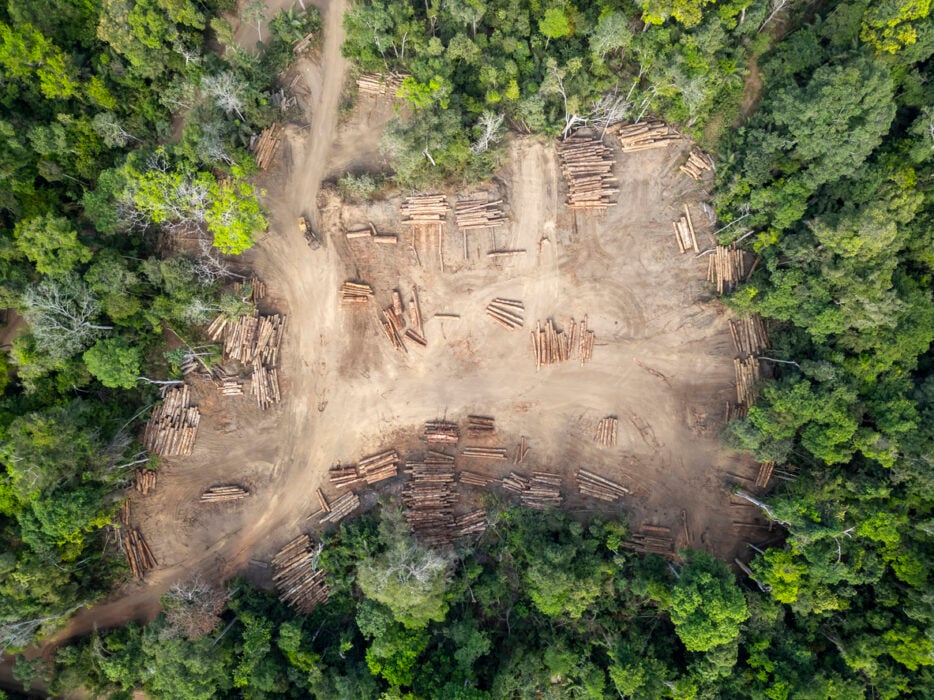
New satellite platforms like OPERA Land Surface Disturbance Alert incorporate data from NASA’s Landsat and European Space Agency’s Sentinel-2 satellites to detect vegetation loss that other systems miss. Unlike older monitoring tools that only tracked tropical forests, these advanced systems monitor managed forests, grasslands, shrublands, and croplands simultaneously.
The comprehensive imagery reveals that forest destruction is happening everywhere—from Canadian wildfire zones to Congo logging operations to cyclone damage in Malawi—creating a global picture of ecosystem collapse that individual monitoring systems couldn’t detect.
7. Satellite technology now catches illegal deforestation within hours of it happening.
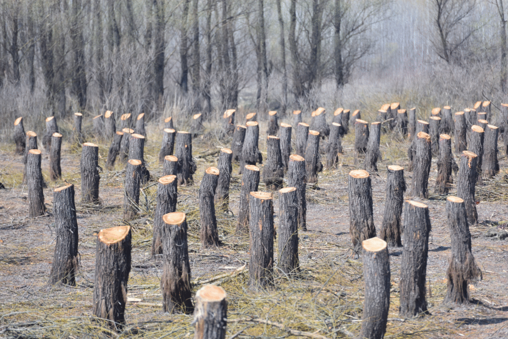
Brazil’s DETER satellite system revolutionized forest protection by sending deforestation alerts to enforcement officers within 24 hours of detecting suspicious activity. The near real-time monitoring completely changed how forest rangers work—instead of random patrols, they can respond immediately with satellite images in hand to investigate specific areas of recent clearing.
This technology helped reduce large-scale deforestation by showing illegal loggers they couldn’t hide from space-based surveillance, though satellite data shows many operations simply shifted to smaller clearing patches to avoid detection.
8. Climate change is making fires burn deeper into soil than satellites ever recorded.
Satellite thermal imaging reveals that modern fires are burning deeper into forest soils than ever before, releasing “legacy carbon” that survived previous fire cycles for generations. These deeper burns, captured by advanced satellite sensors, show fires penetrating permafrost and soil layers that historically remained protected.
NASA’s Arctic-Boreal Vulnerability Experiment uses satellite data to track this phenomenon, finding that increasingly severe fires could fundamentally alter the carbon balance of northern forests, transforming them from carbon sinks into carbon sources that accelerate global warming.
9. Satellite images expose the true scale of forest destruction across entire continents.
Global Forest Watch satellite data reveals that Bolivia’s forest loss surged 200% in 2024, overtaking the Democratic Republic of Congo as the second-largest source of tropical forest destruction despite having less than half the forest area.
The continental-scale satellite imagery shows forest loss isn’t confined to well-known hotspots—it’s happening simultaneously across South America, Africa, Southeast Asia, and northern regions. This synchronized destruction, visible only through comprehensive satellite monitoring, suggests climate change is overwhelming forests’ natural resilience on a planetary scale.
10. The satellite data reveals we’re catastrophically behind on global forest protection goals.
Leaders from 140 countries signed the Glasgow Leaders Declaration in 2021, promising to halt forest loss by 2030, but satellite monitoring shows we’re moving in the opposite direction. To meet the 2030 goal, forest loss must decrease by 20% every year starting immediately—instead, 2024 showed an 80% increase in tropical primary forest destruction.
The comprehensive satellite record demonstrates that 17 of the 20 countries with the largest forest areas have higher forest loss today than when the agreement was signed, revealing a widening gap between climate promises and environmental reality that space-based monitoring makes impossible to ignore.