
Experts reveal which U.S. coastlines face the highest risk and what warning signs to watch for.
Tsunamis represent one of nature’s most powerful and destructive forces, capable of generating waves that travel across entire ocean basins at jet-like speeds. These massive water walls form when underwater earthquakes, landslides, or volcanic eruptions suddenly displace enormous volumes of seawater. While many Americans associate tsunamis primarily with distant events in Japan or Indonesia, scientists have identified significant tsunami risks along multiple U.S. coastlines.
The geological conditions that create tsunamis exist in waters surrounding American shores, from active fault systems off the Pacific Coast to potential landslide zones in the Atlantic. Understanding these risks helps coastal communities prepare for scenarios that could unfold with little warning, potentially affecting millions of people living in vulnerable areas along thousands of miles of American coastline.
1. The Cascadia Subduction Zone represents the most serious tsunami threat to the continental United States.
This 600-mile fault system stretches from Northern California to British Columbia, where oceanic plates slide beneath the North American continent. The zone produces magnitude 9.0 earthquakes approximately every 500 years, with the most recent occurring in 1700. When this fault ruptures, it displaces massive seafloor areas, creating tsunamis that reach Pacific Northwest coasts within 15 to 20 minutes of the initial earthquake.
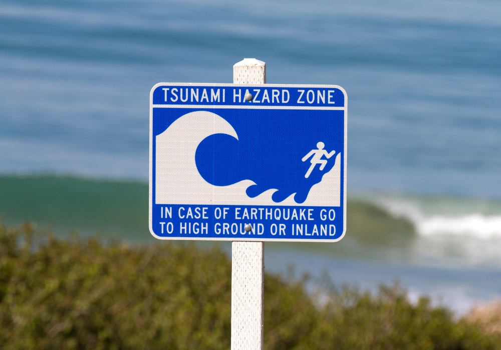
The Cascadia zone’s proximity to major cities like Seattle and Portland makes it especially dangerous. Unlike distant tsunami sources that provide hours of warning, Cascadia-generated waves arrive before evacuation can occur in many areas. Prepare by learning your area’s tsunami evacuation routes and understanding that strong earthquake shaking serves as the only warning you may receive to move immediately to higher ground.
2. A major Cascadia earthquake could generate tsunamis reaching the coast within minutes.
Sudden seafloor displacement from a Cascadia rupture pushes enormous water volumes upward and outward in all directions. Computer models show waves beginning to impact the nearest shorelines within 15 minutes, with heights varying based on underwater topography and coastal geography. The first wave often arrives as a rapid withdrawal of water from harbors and beaches, followed by successive waves that can continue for hours.
This extremely short warning time means traditional evacuation methods like sirens and emergency broadcasts may not provide sufficient notice for escape. Coastal residents and visitors must recognize natural warning signs and act immediately without waiting for official instructions. If you feel strong earthquake shaking while near the Pacific Northwest coast, move to higher ground immediately and stay there until authorities confirm the danger has passed.
3. Alaska’s seismic history demonstrates America’s vulnerability to major tsunami events.
Alaska experiences frequent large earthquakes due to active tectonic plate boundaries, generating tsunamis that have impacted both local communities and distant coastlines. The 1964 Great Alaska Earthquake produced tsunamis that killed people in Oregon, California, and Hawaii, demonstrating how Alaska-generated waves can affect the entire Pacific Coast. Alaska also serves as an early warning system, as earthquakes there provide several hours of advance notice for tsunami arrival in the lower 48 states.
Alaska’s tsunami monitoring networks represent the first line of defense for Pacific Coast communities. When major earthquakes occur in Alaska, warning systems activate to provide evacuation time for distant areas. Stay informed about tsunami warnings issued for Alaskan earthquakes, as these events can generate dangerous waves along the entire West Coast even when the earthquake itself isn’t felt locally.
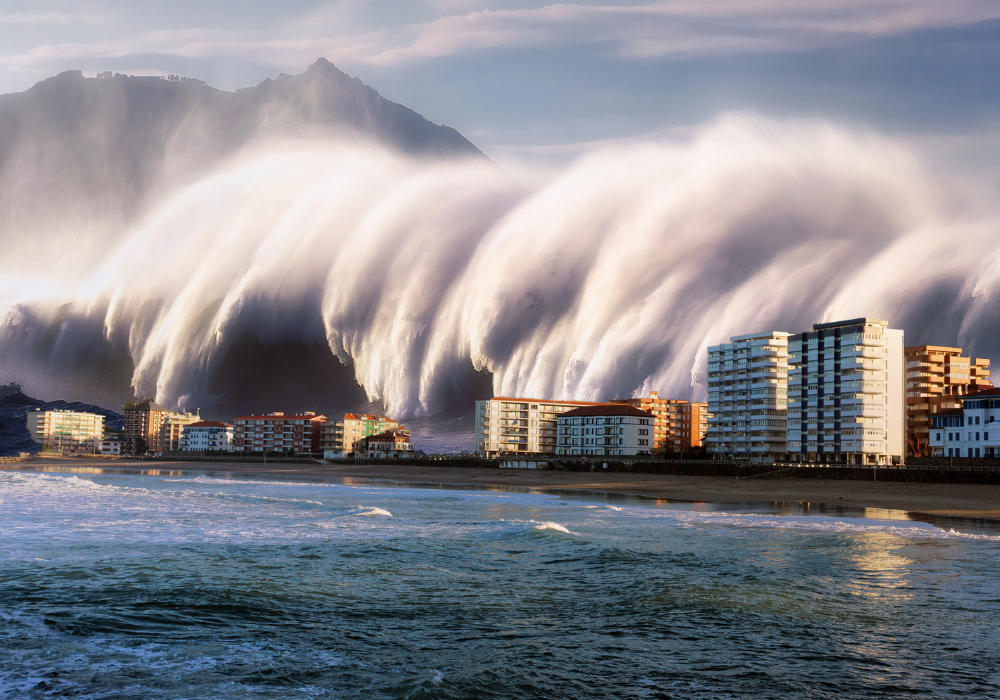
4. Scientifically modeled tsunami waves could reach heights equivalent to multi-story buildings.
Realistic tsunami scenarios for major U.S. coastal areas predict wave heights ranging from 30 to 100 feet in some locations, with the highest waves occurring where underwater topography focuses wave energy toward shore. These heights represent the vertical measurement of water above normal sea level, not the Hollywood-style walls of water often depicted in movies. The actual impact involves rapidly rising water levels that surge inland like extremely fast-moving floods.
Wave height varies dramatically based on local geography, with some areas experiencing relatively modest increases while nearby locations face devastating inundation. Understanding your specific area’s risk requires consulting local tsunami hazard maps rather than relying on general regional predictions. Contact your local emergency management office for area-specific tsunami risk information and evacuation guidance tailored to your community’s unique geographic vulnerabilities.
5. The difference between realistic tsunami threats and exaggerated scenarios matters for proper preparation.
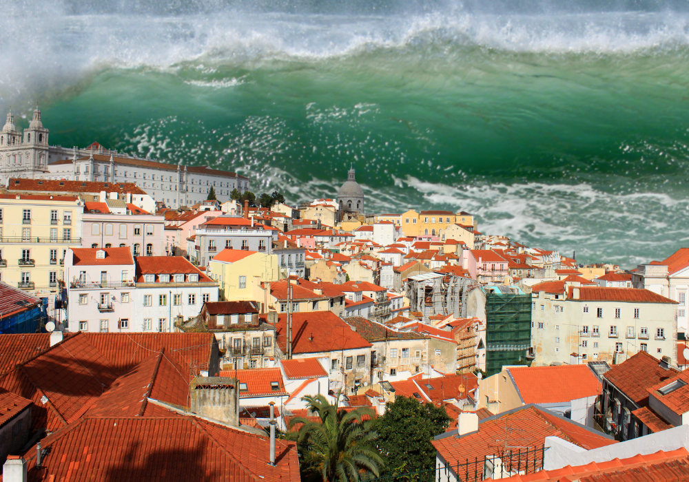
Media portrayals often show tsunamis as towering walls of water hundreds of feet high, but scientifically modeled events typically involve rapidly rising water levels that flood inland areas rather than building-height vertical waves. Real tsunamis behave more like extremely fast-moving tides that continue rising far above normal levels, carrying debris and maintaining dangerous currents for hours. The greatest danger comes from the force and speed of moving water rather than dramatic wave heights.
Understanding realistic scenarios helps people prepare appropriately without becoming paralyzed by fear or dismissive due to exaggerated expectations. Actual tsunami impacts involve powerful currents, floating debris, and contaminated flood waters that can be deadly even at relatively modest depths. Focus your preparation on evacuation planning and situational awareness rather than trying to survive impossible movie-style scenarios.
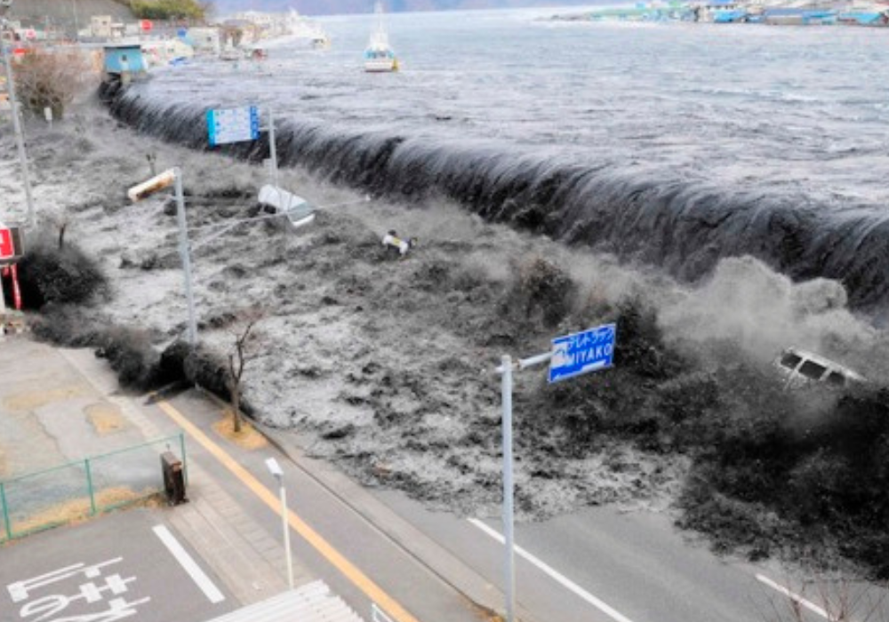
6. Historical tsunami events have repeatedly demonstrated the threat to American coastlines.
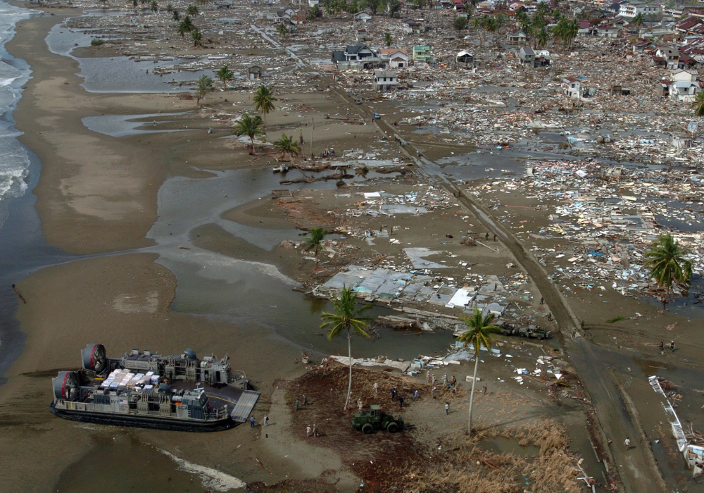
The United States has experienced numerous destructive tsunamis throughout recorded history, from the 1946 Aleutian tsunami that killed 165 people in Hawaii to the 2011 Japan tsunami that caused significant damage in California, Oregon, and Hawaii. The 1700 Cascadia tsunami left geological evidence and oral histories documenting waves that traveled far inland along the Pacific Northwest coast. These historical events provide crucial data for understanding potential future impacts.
Past tsunamis offer valuable lessons about wave behavior, community vulnerability, and effective response strategies. Historical records show that tsunami damage often occurs in unexpected locations due to local geographic factors that focus wave energy. Learn about tsunami history in your area through local museums, emergency management offices, and geological surveys to understand how past events might inform future risks and preparation strategies.
7. Atlantic Coast tsunami risks exist but differ significantly from Pacific threats.
While less frequent than Pacific events, Atlantic Coast tsunamis remain possible through underwater landslides, distant earthquakes, or potential volcanic collapse scenarios. The often-discussed La Palma volcano collapse scenario involves theoretical massive landslides that could generate trans-Atlantic tsunamis, though most scientists consider this a low-probability event. More likely Atlantic tsunami sources include submarine landslides along the continental shelf or earthquakes in the Caribbean region.
Atlantic Coast tsunami risks are generally lower than Pacific risks due to different geological conditions and greater distances from major fault systems. However, the Atlantic Coast’s dense population and limited tsunami preparedness infrastructure could make even modest events more impactful. East Coast residents should maintain basic tsunami awareness while focusing on more probable coastal hazards like hurricanes and storm surge.
8. Major tsunamis could penetrate miles inland depending on local topography.

Tsunami inundation distances vary dramatically based on coastal elevation, river valleys, and underwater geography, with some areas vulnerable to flooding several miles inland. Low-lying coastal plains and river valleys provide pathways for tsunami water to travel far from the immediate shoreline, while steep coastal bluffs limit inland penetration. Elevation above sea level matters more than distance from shore when determining tsunami safety zones.
Understanding your area’s specific inundation risk requires consulting detailed tsunami hazard maps that account for local topography rather than making assumptions based on distance from the ocean. Many areas that seem safely inland may actually lie within tsunami flood zones due to river valleys or low elevations. Identify the nearest high ground or designated tsunami evacuation area, and practice reaching these locations quickly from places where you commonly spend time.
9. Warning times for local tsunamis can be measured in minutes rather than hours.
Locally generated tsunamis from nearby earthquake sources provide extremely limited warning time, often arriving before official evacuation orders can be issued or sirens activated. Natural warning signs like strong earthquake shaking or unusual ocean behavior may be the only advance notice available for near-source events. Distant tsunamis provide more warning time but still require immediate action once alerts are issued.
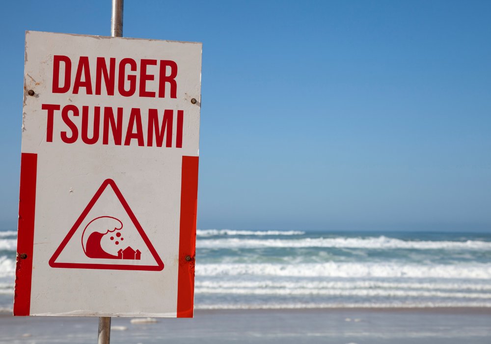
The short warning times for local events emphasize the importance of personal preparedness and immediate response to natural warning signs. Don’t wait for official warnings if you experience strong coastal earthquake shaking or observe unusual ocean recession. Develop personal response plans that prioritize immediate evacuation to high ground based on natural warning signs rather than relying solely on technological warning systems.
10. Coastal communities implement multiple strategies to reduce tsunami risks and improve emergency response.
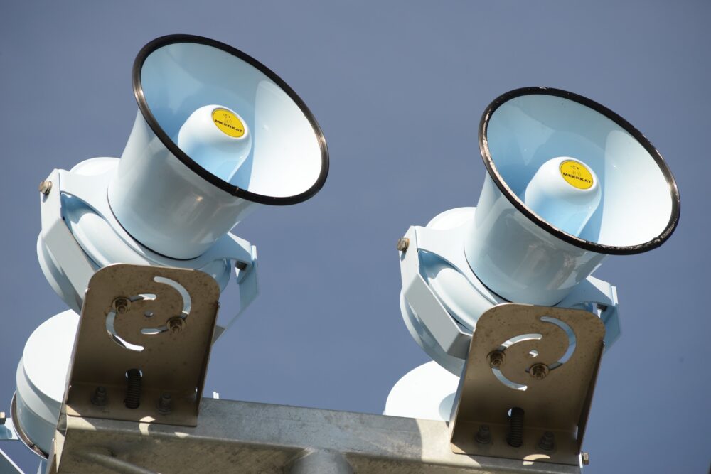
Modern tsunami preparedness includes early warning systems, evacuation route planning, public education programs, and land use regulations that limit development in high-risk areas. Many Pacific Coast communities have installed warning sirens, created elevated evacuation structures, and developed detailed response plans based on scientific risk assessments. Building codes in some areas now account for tsunami forces, while schools and businesses conduct regular evacuation drills.
Individual preparedness remains crucial regardless of community-level efforts, as personal response decisions ultimately determine survival outcomes. Learn your area’s evacuation routes, practice reaching high ground quickly, and maintain emergency supplies for potential post-tsunami isolation. Participate in community preparedness activities and stay informed about local tsunami risks through official emergency management channels and scientific monitoring organizations.