
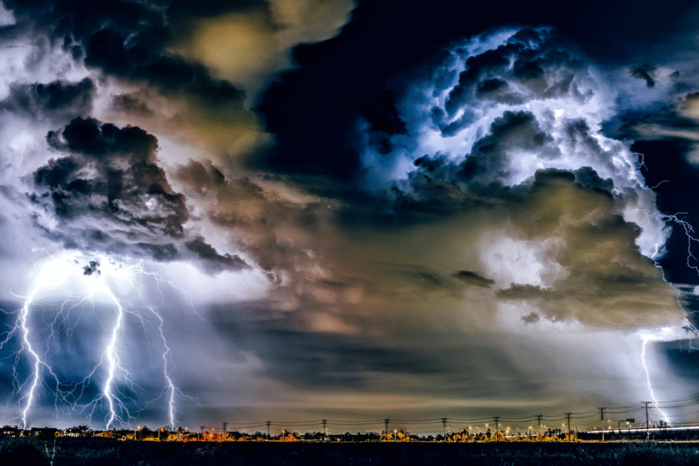
Jet stream patterns directly influence how storms gain strength and change quickly.
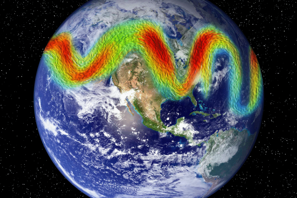
The jet stream, a powerful ribbon of high-altitude winds, plays a crucial role in shaping weather patterns and storm behavior. When its path bends sharply, it can create conditions that allow storms to intensify rapidly by enhancing atmospheric dynamics and temperature contrasts. Understanding how jet stream shifts interact with air masses and moisture helps explain why some storms escalate quickly, affecting forecasts and preparedness efforts worldwide.
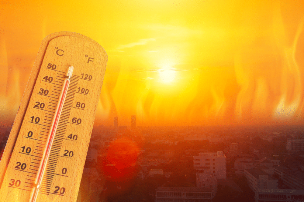
1. Rising ocean temperatures increase the energy available for storm development.

Rising ocean temperatures provide more energy for storm development by heating surface waters. This extra warmth evaporates more water, increasing humidity and fuel for weather systems. The warm, moist air rises and cools, releasing energy that strengthens storm features, raising intensity levels.
As ocean temperatures rise, the increased energy can lead to more intense cyclogenesis, where storms form. The additional moisture load energizes thunderstorms further, contributing to rapid storm intensification. Understanding these dynamics helps meteorologists better predict storm development, especially in tropical regions where oceanic heat content is highest.
2. Changes in atmospheric pressure patterns alter jet stream flow significantly.
Atmospheric pressure patterns significantly influence the flow of the jet stream, dictating its meandering paths. High and low-pressure systems create gradients that push or pull the stream, altering its speed and direction. Such deviations can affect weather stability and storm intensity.
When pressure patterns shift, they can cause the jet stream to dip or elevate unusually. These changes often result in enhanced cyclonic activity, as the altered jet stream creates regions more conducive to storm development. Distinguishing these influences supports improved prediction models for weather forecasting.
3. Variations in polar air masses disrupt usual jet stream paths.
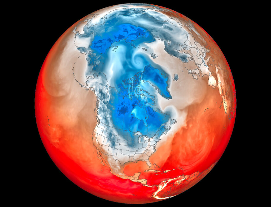
Polar air masses, when they vary, impose disruptions on the traditional paths of the jet stream. These variations result from differential heating and cooling in polar regions, affecting the stream’s consistency. Such disruptions can intensify weather events by causing unexpected bends.
When especially cold polar air masses interact with adjacent air, the jet stream can shift, affecting downstream weather patterns significantly. These alterations might lead to severe winter storms and cold outbreaks, demonstrating the critical role of polar dynamics in weather forecasting.
4. Strong temperature gradients between poles and tropics drive faster jet flows.
Strong temperature gradients between poles and tropics create faster jet stream flows as differences in warm and cold air drive powerful atmospheric currents. These swift movements in the upper atmosphere have crucial effects, influencing storm tracks and intensities.
The more pronounced the temperature difference, the more dynamic the jet stream becomes, often enhancing its influence on weather systems. Such gradients are pivotal in sustaining storm energy, contributing to rapid developments. Recognizing these relationships helps forecasters anticipate potential severe weather scenarios by analyzing gradient shifts.
5. Increased moisture levels in the atmosphere feed storm intensification.

Increased moisture levels in the atmosphere supply the fuel necessary for storm intensification. Water vapor, when present in large amounts, releases latent heat energy as it condenses, propelling thunderstorms and cyclones to strengthen rapidly and maintain power.
As atmospheric moisture content rises, storms can draw on this energy source to amplify their impact. This process is particularly evident in tropical cyclones, where warm seas continually replenish atmospheric moisture. Understanding the implications of moisture on storm strength aids in advancing warning systems for severe weather events.
6. Seasonal shifts in solar radiation impact jet stream positioning consistently.

Seasonal shifts in solar radiation consistently adjust the positioning of the jet stream, as uneven heating occurs globally. During different seasons, variations in sunlight intensity alter temperature distributions, prompting the jet stream’s path to change in response to thermal contrasts.
These positioning shifts influence regional weather patterns, potentially leading to prolonged periods of wet or dry conditions. Season-driven alterations in the jet stream’s course also affect storm tracks, making the recognition of these seasonal effects essential for accurate long-term weather predictions.
7. Mountain ranges force air currents to bend and change jet stream direction.

Mountain ranges impact air currents, compelling the jet stream to bend and adjust its path. As air flows over and around elevated terrain, these natural obstacles force atmospheric waves that can permanently alter the stream’s direction, affecting downstream weather patterns.
This rerouting can intensify weather phenomena such as rain shadows and severe storms on mountains’ lee sides. Recognizing how topographical features steer jet stream paths enhances understanding of localized climate effects. This interaction demonstrates the importance of terrain in shaping atmospheric conditions and influencing meteorological outcomes.
8. Large-scale weather systems can cause the jet stream to stall temporarily.
Large-scale weather systems create conditions for the jet stream to stall temporarily, holding its position over a region. This stalling results from interactions with stationary high pressure or blocking systems that impede typical progressive movement.
When these systems persist, they can lead to extreme and lasting weather events, such as heatwaves or prolonged rainfall. Understanding how robust these patterns are is vital, as stalling jet streams can have profound impacts by trapping weather systems in place, disrupting expected weather changes.
9. Human-induced climate change modifies temperature distributions affecting jet streams.
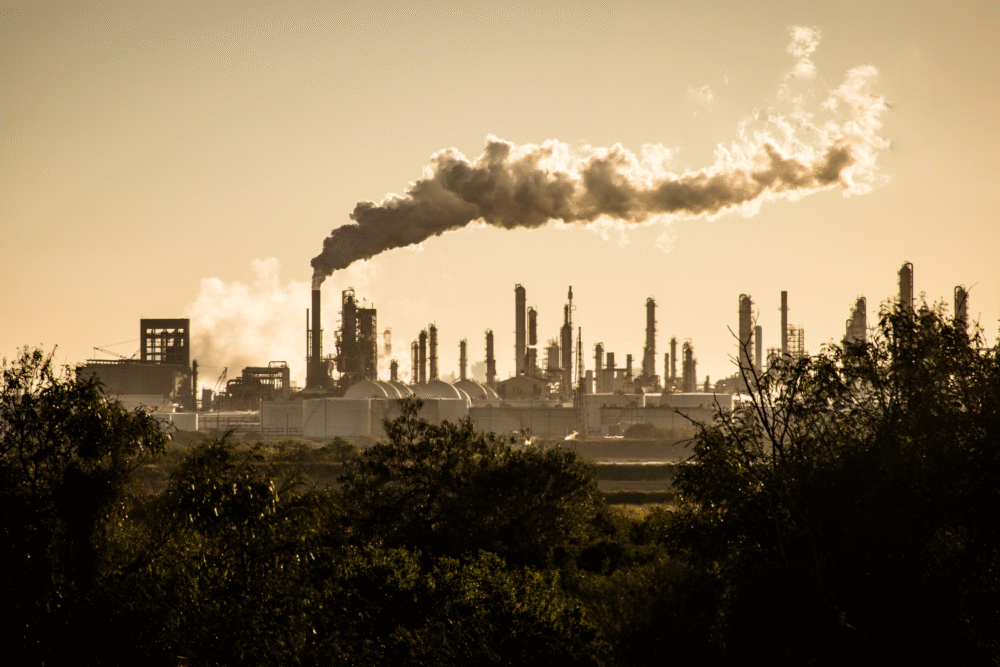
Human-induced climate change disrupts temperature distribution, leading to modifications in jet streams. Warming, especially in polar regions, reduces temperature differentials, potentially altering jet stream shape and flow dynamics. These changes affect weather patterns globally, including storm tracks and intensities.
As climate change progresses, the historic stability of jet streams may weaken. This can result in more frequent or severe weather events, underscoring the need for a deeper understanding of climate mechanisms. Observing these influences is crucial for predicting long-term shifts in weather behavior globally.
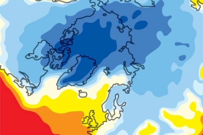
10. Sudden stratospheric warming events lead to rapid jet stream alterations.
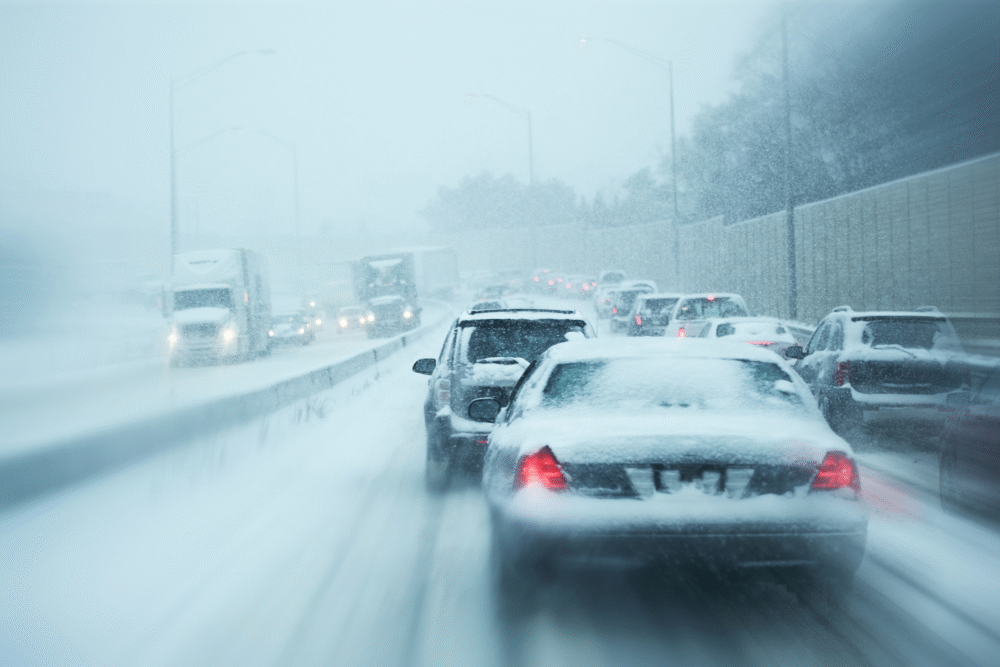
Sudden stratospheric warming events induce rapid alterations in the jet stream by raising upper atmospheric temperatures abruptly. These warming occurrences can displace or split the polar vortex, causing sudden shifts in jet stream paths, affecting weather at mid-latitudes.
When the polar vortex is disrupted, cold Arctic air can descend into lower latitudes, leading to severe winter conditions. Monitoring these warming events is significant for anticipating dramatic weather alterations. Their influence illustrates the complexity of atmospheric interactions dictating short and long-term weather changes.
11. El Niño and La Niña phenomena influence the jet stream’s behavior widely.

El Niño and La Niña phenomena significantly alter jet stream behavior, driven by oceanic temperature anomalies in the Pacific. El Niño usually enhances southern jet streams, while La Niña bolsters northern flows, altering precipitation and weather across different regions.
This shifting can result in storms intensifying or weakening depending on regional effects. For instance, El Niño often brings wetter conditions to the southern U.S., while La Niña might promote drier patterns. Understanding these consequences facilitates improved seasonal forecast accuracy, thanks to the clear influence of these phenomena on global jet streams.
12. Land and sea temperature differences create pressure changes influencing jet stream bends.
Land and sea temperature differences cause pressure changes influencing the jet stream’s path. As air moves between these contrasting environments, differential heating affects atmospheric pressure equilibrium, generating shifts in the jet stream’s direction and speed.
These changes often lead to regional weather variations, such as intensified coastal storms or inland heatwaves. Identifying how these temperature differentials impact atmospheric flow structures enables better predictions of localized weather phenomena and enhances awareness of the critical role coastlines play in shaping atmospheric dynamics.